Wednesday, May 15, 2019

Original Villages | San Antonio Tecómitl, Milpa Alta: Fountain Play, Quinceañera and Carnaval

Water Play


The taxi bringing us from the Tláhuac Metro station, at the end of Line 12, to Pueblo San Antonio Tecómitl drops us off at the central plaza. The pueblo stands literally at the northeast entrance to Delegación Milpa Alta, next door to San Juan Ixtayopan (Place on White Soil), in Delegación Tláhuac. We had visited San Juan a year ago in January for its Fiesta of the Virgin of Solitude. Tecómitl is Nahuatl for the Place Where There Are Stones for Cooking Corn (possibly heating it to prepare for adding lime to the masa, corn dough made from dried corn, the calcium making it more nutritious) (from Toponimias de los pueblos de Milpa Alta, [Toponomy (history of place names) of the Pueblos of Milpa Alta] from the online magazine Nosotros, (Us), Aug. 14, 2017).

This is our first visit to Delegación/Alcaldía Milpa Alta to witness a community celebration. It is a Carnaval being held in early April, before Easter, but we have no information as to when it will begin. Our photographer's eye roves around the plaza, looking for whatever is of interest.  (See our introduction to Delegación/Alcaldía Milpa Alta: Countryside in the City.)

In one large corner, next to a modern clock tower, is a fountain-playground, clearly a fairly recent addition to the old space. Water shoots up in changing and unpredictable patterns from holes spread across the concrete pavement. With a warm sun shining, these fountains absolutely call children to run through their showers, just as we did through lawn sprinklers in our childhood. Such fountain-playgrounds are a popular innovation in Mexico City. There is one on the plaza in front of the historic Chapel of the Holy Conception Tlaxcoaque in South Centro and another at the Monument to the Revolution.


We sit on one of the benches alongside the watery playground, together with parents and other adults, just watching and enjoying the children´s joyous play.  Our photographer's eye relishes, as always, in the children at play but also roves around the plaza to see what else might be of interest.

Quinceañera


Suddenly we notice a young woman crossing the plaza, dressed in an elaborate, embroidered gown and wearing a huge, embroidered sombrero. Two older adults accompany her, evidently her parents. Four flaco (skinny) teenage boys, dressed in white charro (fancy cowboy) suits follow behind. They move at a hurried pace. At first, we wonder whether she is to be part of the Carnaval. They frequently include "queens" riding elaborate coches alegóricos, floats designed with some symbolic or historic theme.


Then we realize they are headed for the church, which stands, in classic Spanish village design, at  one side of the plaza.

The steeple of the Church of San Antonio
peaks over the wall of the church atrio (atrium).

Church of San Antonio.
Like many other old churches
in the city,
it was damaged in the earthquake
of September 2017 and is closed.
Services are being held
beneath a large tent in the atrio.

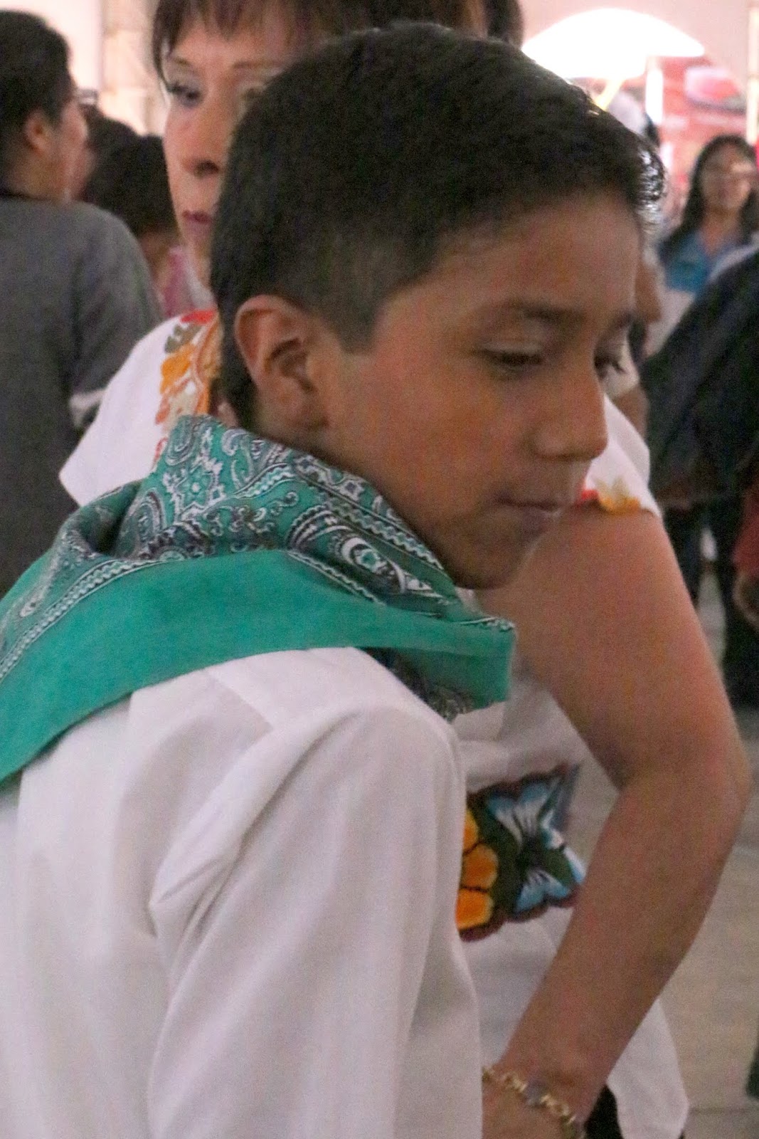
The young woman,
named, like our wife, Jenny,
is celebrating her quinceañera,
her fifteenth birthday,
her coming of age.
In past times, it meant a girl
was available for marriage. 

Abrazo de una abuela orgullosa,
hug from a proud grandma.

Jenny with her obligatory escorts.
After the ceremony, there are the requisite formal, professional photographs,
which we piggyback.


A most beautiful young woman
in the moment honoring her coming of age.

The celebratory group leaves the atrio by a side entrance. By the time we get to the street, they have disappeared. Then we are presented with another surprise:

A cabalgata (parade) of horsemen in cowboy attire pass by.

This caballero (horseman)
knows how to "sit a horse".
And the horse knows how to be
"on the bit".

Then Jenny, in her glory, is escorted by.

¡Carnaval!


We are relishing our good fortune to have happened upon this quinceañera with its additional gift of a cabalgata, when we hear the sounds of cohetes (rocket-style firecrackers) and a brass banda coming from the other end of the plaza. They are the sure signs that the Carnaval desfile (parade) is arriving. We hurry across the plaza to catch up with it.


La Banda


Comparsa (troupe) of chinelos, the "disguised ones".


This is the most explicit portrayal
of the Spanish Conquest of the Azteca/Mexica
we have ever seen on any fiesta costume.
The yellow and black-spotted figure
is an Aztec jaguar warrior.


Another comparsa from Barrio Xaltipac,
one of five composing San Antonio Tecómitl.
(Barrio Bajo, low, may refer to it being 

at the edge of the chinampas, man-made islands in 
former Lake Chalco created for farming.)


Alguna Gente del Pueblo | Some People of the Pueblo


And a good time was had by all.

A Rich Day in San Antonio Tecómitl: Three for One


Wow! What a day! We arrived in San Antonio Tecómitl not knowing what to expect, which is the case with all of our ambles to new pueblos. We did expect some kind of Carnaval, but we had no idea of what to expect as to its size or complexity, let alone its level of energy. We were given a very fun Carnaval. It was not grand in size, but it was full of the ánimo mexicano, Mexican spirit, we always hope to find on our adventures to pueblo celebrations. 

And on top of that, there was the exuberant ánimo of children running with delight through cascades of cool water. Then there was a different ánimo, more subdued than the others, one of a moment of significant transformation in a person's life. A beautiful young woman bloomed towards adulthood at her quinceañera. And it was topped off with a cabalgata, always a treat for this old caballero! Who, as the saying goes, could ask for anything more?

We leave San Antonio Tecómitl, our first foray into Delegación/Alcaldía Milpa Alta ("Milp'alta" as the locals pronounce it) muy satisfecho (very satisfied) and full of alegría (joy). We hope to get back to "Milp'alta" soon. After all, there are twelve other pueblos, further up the hillside, to get to know.

Delegación Milpa Alta (light yellow) is in the southeast corner of Mexico City.
It is just south of Xochimilco (pink),
and east of Tlalpan (mustard yellow)

Pueblo San Antonio Tecómitl (yellow/red star) is at the northeast entrance to Delegación/Alcaldía Milpa Alta,
directly adjacent to Pueblo San Juan Ixtayopan in Delegación/Alcaldía Tláhuac.

Sunday, May 12, 2019

Original Villages | Delegación/Alcaldía Milpa Alta: Countryside in the City

Countryside in the City


One of our goals, our "bucket list", that has emerged as we developed Mexico City Ambles and started visiting original indigenous pueblos in the spring of 2016, was to get to all sixteen of the delegaciones (boroughs), now called alcaldías (mayoralties). We readily got to the majority, which are accessible by the Metro or via taxis along main highways and avenues. By the beginning of this year, we had made it to fiestas in about sixty pueblos in twelve of the delegaciones.

We had visited each of the other four once, but not to attend a fiesta in a specific pueblo. These four are on the periphery of the city: Atzcapotzalco in the northwest, Cuajimalpa and Magdalena Contreras in the mountains in the west and Milpa Alta in the southeast — all are a challenge to get to from our central location in Coyoacán.

Finally, this spring, during Carnaval season, we got the opportunity to attend a celebration in Milpa Alta, in Pueblo San Antonio Tecómitl, but before we present our experience there, we need to introduce the delegación/alacaldía.

Delegación Milpa Alta (light yellow) is in the southeast corner of Mexico City.
It is just south of Xochimilco (pink),
and east of Tlalpan (mustard yellow)

Milpa Alta and Its Pueblos.
As is clear from this Google Earth shot, the pueblos are all located
in the northern part of the delegación/alcaldía, a sloping piedmont region.

The dark green to the south are the evergreen forests on the steep slopes
of the Chichinautzin range of volcanoes. 
Note the many small cinder cone volcanoes dotting the landscape.

Welcome to Milpa Alta
Photo: Facebook page of San Bartolomé Xicomulco

There are thirteen pueblos in the Milpa Alta (meaning High Field; residents elide the two "a"s into one, pronouncing it as a single word, Milpalta). In area, it is the second largest delegación/alcaldía — taking up the entire southeastern section of Mexico City. All the pueblos are indigenous; they existed before the Spanish Conquest. The area around them is sloping, open countryside, filled with fields of nopal cactus. South of the pueblos, the land rises sharply to towering volcanoes of the Chichinautzin range. It contains six volcanoes over 10,500 ft. (3,200 meters) in altitude, rising 3,000 feet (915 meters) above the Valley floor. (See our post Encountering Mexico City's Many Volcanoes: Giants on All Sides.) 

Arriving in Milpa Alta, you cannot believe that you are still in Mexico City, but must be somewhere in the rural "províncias", the countryside in some state far away, not only in space but also in time, from the Spanish colonial Zócalo and the globally post-modern Paseo de la Reforma, the central plaza and major boulevard in the city's center.

Nopal fields spread out next to Pueblo San Bartolomé Xicomulco

The low volcano at far left is Teuhtli
where the delegaciones/alcaldías of Milpa Alta, Xochimilco (to the northwest) and Tláhuac (to the northeast) all meet. 
It has great symbolic significance for the three as the center of their historically rural world. 
What remains of Lake Chalco is in the distant center. 
Photo from Facebook page Xicomulco, which shares many beautiful photos of the Milpa Alta countryside.

History of Milpa Alta


The original settlers of the area are believed to have been Nahuatl-speaking Tolteca farmers linked to the altepetl (city-state with other subject villages) of Culhuacán on the Iztapalapa Peninsula.

Probably in the 12th century CE, other Nahuatl-speaking people from Xochimilco (itself founded as an altepetl  in 919 CE) and Nahuatl-speaking hunter-gatherer tribes — possibly from the eastern part of the Valley and collectively called chichimecas (barbarians) by the settled agrarian people of the Valley — imposed themselves on the Tolteca population. Some of them founded the pueblo of Malacachtépec Momoxco (possibly meaning "place of altars surrounded by mountains") and a number of other villages. 

Near the end of the 13th century, the Tolteca of Culhuacan, with the help of their then subjects, the Mexica, conquered Xochimilco, Malacachtépec Momoxco and the other pueblos of the area, only to be conquered themselves in the latter part of the 14th century by the Tepaneca of Aztcapotzalco, on the southwest side of Lake Texcoco. The Tepaneca did this with the support of their new client, the Mexica altepetl of Tenochtitlan, established in 1325 on an island in the lake. In 1428 the Mexica, in turn, conquered Aztcapotzalco and took control of the western and south-central parts of the Valley, including Xochimilco and Malacachtépec Momoxco. This was the beginning of the so-called Azteca Empíre.

Malacachtépec Momoxco and the surrounding pueblos were conquered by the Spanish in 1529. The Franciscans immediately established a visita (visited church, i.e., without a resident priest) in Malacachtépec Momoxco, dedicated to the Virgin of the Assumption. They renamed the pueblo La Asunción de Milpa Alta. A  church building was constructed between 1585 y 1630 and still stands in the center of what is now called Villa Milpa Alta.

Church of the Assumption,
Villa Milpa Alta

Unfortunately, like many other old churches in the City, the church was damaged
in the earthquake of Sept. 2017 and closed at the time we visited.
Hopefully, it will be restored. 
In the meantime, church services are being held
in a tent in the beautiful atrio (atrium).

Following the Spanish model of provinces divided into municipalities, La Asunción de Milpa Alta and its neighboring pueblos were made part of the municipality of Xochimilco, called sujetos under the political control of the cabacera (head town) of Xochimilco, where there was a Franciscan convent, San Bernardino de Siena, built in 1535. After independence in 1821, the municipality of Xochimilco, including Milpa Alta, was made part of the new state of Mexico. 

In the mid-nineteenth century, Milpa Alta and its pueblos were transferred from Xochimilco and made part of the municipality of Tlalpan. At the same time, both municipalities, along with others such as Coyoacán, were transferred by the federal government from the state of Mexico and incorporated as municipalities within the much expanded Federal District. (See our post: How Mexico City Grew From an Island Into a Metropolis.)

At the time of the Mexican Revolution (1910-|1919), much of the land was part of a great, Spanish-owned hacienda growing corn, based in Chalco, to the northeast, at the end of what had been Lake Chalco (now in the state of Mexico), and the people worked as peones, (farm workers) on the hacienda.

During the Mexican Revolution (1910-1919), the region was an important bastion of the Liberation Army of the South, led by Emiliano Zapata. (See our page: Mexican Revolution: Its Protagonists and Antagonists.) After the Revolution, the hacienda was broken up and the land was returned to the indigenous pueblos as ejido (communally held) land.

Because of the hilly terrain, the primary crop grown was maguey (agave, a succulent) from which pulque beer was made from its miel, honey, i.e. sap, as well as fiber and other products. When the post-revolutionary federal government cracked down on the production of pulque, the campesinos (rural farmers) slowly turned to growing nopal (from its Nahuatl name) cactus (Opuntia ficus-indica) whose pads are a major Mexican vegetable. Now Milpa Alta, still predominantly a rural area, grows 78% of the nopal consumed in the country. Some 7,500 hectares (over 18,500 acres) are planted with the crop, producing 450 thousand metric tons of nopal each year.

In 1927, Milpa Alta was separated from Tlalpan and made one of the delegaciones (boroughs) of the Federal District. In 2016, along with the others, it became one of sixteen alcaldías (mayoralties) of Mexico City, when the City officially replaced the Federal District as a politically self-governing entity of the nation, virtually equal to the thirty-one states.

Continuing Nahua Identity


With more than 3,000 speakers of Nahuatl, representing 4% of the population, Milpa Alta is the delegación with the highest proportion of speakers of indigenous languages ​​in Mexico City. Up until the mid-20th century, the majority of the population spoke Nahuatl. Traditional customs remain strong, with mayordomos (chief caretakers) and cofradías (religious brotherhoods) organizing religious fiestas. The majority of agricultural land is ejido, communally owned and worked. There are active endeavors in some of the pueblos to recover the speaking of Nahuatl.

The thirteen residential areas of Milpa Alta (one "villa" — village with traditionally higher status — and twelve pueblos) each identify their origin with one or another of the Nahua tribes that populated the region in pre-Hispanic times.


Nine villages located in the heart of Milpa Alta and on the northern slope of the Chichinauhtzin recognize themselves as descendants of the founders of Malacachtépec-Momoxco. These are (with translations of their Nahuatl names from Toponimias de los pueblos de Milpa Alta, [Toponomy (history of place names) of the Pueblos of Milpa Alta] from the online magazine Nosotros, (Us), Aug. 14, 2017):
  • Villa Milpa Alta, (formerly Malacachtépec-Momoxco)
  • Pueblo San Jerónimo Miacatlán, (Place of Reed Beds)
  • Pueblo San Agustín Ohtenco (Place Next to the Path)
  • Pueblo San Juan Tepenáhuac (Hill Near the Water)
  • Pueblo San Francisco Tecoxpa (Place of Yellow Stones)
  • Pueblo Santa Ana Tlacotenco (Place of Rough Ground)
  • Pueblo San Lorenzo Tlacoyucan, (Place Where the Reeds Sink)
  • Pueblo San Pedro Atocpan (Place on the Plains)
  • Pueblo San Pablo Oztotepec (Hill of Caves)
Two pueblos are located on the western edge of the delegación, adjacent to Delegación Xochimilco, on the slope of the Cuauhtzin volcano. They are descendants of the Xochimilca people.  They are:
  • Pueblos San Bartolomé Xicomulco (Navel of the Mountainside) and 
  • San Salvador Cuauhtenco (Place of the Woodcutters)
Finally, in the northeast are two pueblos:
  • Pueblo San Antonio Tecómitl (Place Where There Are Stones for Heating Corn )and 
  • San Nicolas Teteñco.
Historically, they have been related to the nearby Pueblos San Juan Ixtayopan, San Andrés Míxquic and San Pedro Tláhuac, in Delegación Tláhuac. Like the pueblos in Tláhuac, these pueblos have traditionally farmed the chinampas, man-made islands, in what was Lake Chalco.

By pure chance, it is San Antonio Tecómtl, that we get to visit first. (Wikipedia en español)

Sunday, May 5, 2019

"Paisley" | The Pattern That Traveled from Kashmir, Asia, to Mexican Campesinos

In June of 2010, already living in Mexico, we joined a delegation of U.S. citizens sponsored by the NGO Witness for Peace traveling to Oaxaca in southern Mexico. The objective was to learn from leaders of migrant support organizations and migrants themselves about the economic dynamics pushing the migration and the challenges faced by migrants to the U.S. from that state and those who passed through there from Central America. We traveled to the Isthmus of Tehuantepec, a narrow, relatively flat region at Oaxaca's southern border with Chiapas — the narrow end of the funnel that migrants from Central America had to pass through to cross Mexico and try to reach the U.S.

Our host in the town of Matías Romero was a Catholic Church which sponsored a shelter for these migrants who passed through on "The Beast", a freight train that traversed the Isthmus. We were the guests of honor, placed in the front pews at a Sunday morning Mass. During the Mass, a group of preadolescent girls and boys, dressed in the traditional clothing of the Isthmus, acted out a New Testament parable of the rich helping the poor. They then performed a traditional dance.

When the dance was finished, they approached each of us in the delegation and gave us several small gifts of local, indigenous artisanry. This gesture of hospitality and good will towards "Americans" brought me to tears, for I was well aware of our country's government's hostility toward Mexican and Central American migrants and also of the severe damage that our "war against drugs" was doing to people of the country. Seeing my tears, the youth gathered around me and gave me abrazos, hugs, of comfort. That touched me even more.

One of the gifts given to us were bandanas, also called paliacates or pañoletas (from pañuelo, handkerchief). They were bright reds and oranges, covered with a design I knew as paisley. I wondered, at the time, how bandanas from southern Mexico came to bear a design I had always assumed came from Asia. I valued them as a touching gift, but having no use for them, kept them in a drawer at home. Recently, Jane and I were looking for small gifts from Mexico to take to our two grandchildren, Caroline and William,  in Chicago. The bandanas or kerchiefs struck me as perfect for this purpose.

In the process, the question of how an Asian design ended up on a Mexican bandana came back to my mind. So I began to research the history of what I knew as paisley. I knew it from paisley ties, which I loved in the 1970s. The short answer is that the pattern came originally from Persia where it appeared before the 6th century.
The following history comes from the article, "A History of Paisley", Slate magazine, Oct. 20, 2015, excerpted from Patternalia: An Unconventional History of Polka Dots, Stripes, Plaid, Camouflage, & Other Graphic Patterns by Jude Stewart, published by Bloomsbury Press.
The pattern was brought to the Indian province of Kashmir in the 15th century by Zain-ul-Abidin, who ruled Kashmir from 1459 to 1470. There the shawls (shal in Hindu) were handwoven out of cashmere wool, the finest of wool that came from the belly of wild sheep in the Himalayas. Grown in the winter, in the summer the animals scraped it off against rocks, where weavers collected it. It could take a year for one weaver to complete a shawl. Sometimes multiple weavers worked on sections of a shawl, which were then deftly sewn together, thus decreasing production time and increasing quantity (and profit).

The shawls' next champion was Akbar the Great, the third Mogul ruler of India (reigned 1556–1605), who made the shawls central to the Kashmiri practice of khil’at, “robes of honor”, ceremonially exchanged in political and religious contexts to establish a clear pecking order. Being on the receiving end made one indebted to, and therefore submissive to the giver.

Emperor Akbar the Great.jpg
Akbar the Great
Note the "paisley" teardrop set ruby,
called the jigha in Hindu, 

on his royal turban.
Wikipedia

Shawls given as khil’at were decorated with all sorts of patterns, but some scholars speculate that the paisley motif came to predominate because it resembled the jigha, a crown jewel pinned to the ruler's turban. The shape is called “boteh" in Persian, "buta" (bud) in Hindu and is variously seen as representing buds on a date palm, traditionally, the "Tree of Life", associated with fertility in general, including human sexual potency, or as the convergence of a stylized floral spray and a cypress tree: a Zoroastrian symbol of life and eternity.

The shawls became popular in Europe when trade by the British East India Company with India developed in the 16th century. Handwoven of cashmere wool, they were prohibitively expensive. Upper-class European women adopted these precious imported shawls as a fashion statement. A town named Paisley in Scotland adapted the Jacquard loom (invented in 1804 by Frenchman Joseph Marie Jaquard), one that used sets of punched cards to produce predesigned patterns (a predecessor of computers) and therefore replaced handlooms, thus enabling mass production. Thus, it became the center of shawl manufacturing in England and the source of its English name. In Spanish, the pattern is called cachemir(a) (cah-che-mír), i.e., from Kashmir.

Along with English and French, well-to-do Spanish women adopted these cachemir shawls for wearing to church in the 18th century. Evidently, some of these women brought them to Mexico.

In the meantime, a much cheaper version of the pattern printed on cotton became available, so any woman could wear paisley or cachemir. How it became the preferred if not the requisite pattern on Mexican campesino bandanas remains unknown. One possible link appears in a photo of the Mexican Revolutionary leader, Pancho Villa, himself from the peón, campesino class.


Mexican Revolutionary leader Pancho Villa
wearing a patterned bandanna,
possibly in a 
cachemir (paisley) pattern.
Wikipedia

In any case, it is clear that in Mexico, this once royal pattern from Kashmir and mark of upper-class Western Europeans is the sine qua non of identifying as or with the rural campesino class.  Perhaps, it is an identification with the populist portion of the Mexican Revolution or only something like the  "Western cowboy" dress of an urban aficionado in the U.S. We have come across the cachemir bandana in a number of fiestas in working-class pueblos and other events celebrating Mexico's rural and/or revolutionary past. Here are some examples:

Cuadrilla de Arrieros, team of mule drivers, participating in a religious fiesta. 

Arriero

Arriero

     
Arriero (left) and participant in Cinco de Mayo, May 5 
re-creation of the battle against the French in 1862

Participant in popular, "folk", festival
of  "son" [Sp. pronunced "sohn"], "sound"

in the sense of the
regional rural music styles
of Mexico in Mexico City

Participants in popular "son" festival. 
These are jóvenes, youth, from Mexico City.

Participants in popular "son" festival. 
More jóvenes, youth, from Mexico City.
He is a musician for a record company. 

The tradition of "son" country music
and the cachemir bandana 
being passed on to an urban youth.

Granddaughter Caroline...
...and Grandson William, "the pirate", 
with Oaxaca bandanas
in Chicago.