Showing posts with label Mexico City. Show all posts

Wednesday, December 8, 2021

Welcome to Mexico City Ambles: Navigating the Blog

Welcome to Mexico City Ambles! Here we seek to present "el imaginario", a vision of the city as embodied in its cityscape, public art and neighborhoods (pueblos and colonias). Over time, as we sought to discover the physical and historical breadth and depth of the City, our search led us to focus on the life of its lesser-known, working-class neighborhoods, many of which were indigenous pueblos existing long before the Spanish arrived and took over 500 years ago. We visit these original pueblos when they are celebrating their traditional fiestas, which are lively, colorful celebrations of their centuries-long communal continuity and unique identity.

¡Bienvenido a Paseos por la Ciudad de México! Aquí buscamos presentar el imaginario, una visión de la ciudad como encarnada en su paisaje urbano, arte público, pueblos y colonias. Si bien buscamos cubrir la amplitud y profundidad física e histórica de la ciudad, nos ha llevado a centrarnos en en la vida de sus pueblos y barrios menos conocidos, muchos de los cuales eran pueblos indígenas que existían mucho antes de que los españoles llegaron y se hicieron cargo desde 500 años. Visitamos estos pueblos originales cuando celebran sus fiestas tradicionales, que son celebraciones coloridas y animadas de su continuidad comunal por siglos y su identidad única.

Escribimos en inglés porque somos norteamericanos y para dar a conocer a otros norteamericanos y hablantes de inglés la ciudad más allá de los lugares turisticos típicos. Sin embargo, es fácil traducir una página en español: vaya a la columna a la derecha. En la parte más alta hay una ventana etiquetada "Translate". Desplace la flecha abajo hasta encuentra "Spanish". Click en ese y inmediatamente todo el texto estará traducido en español por Google. Con certeza, habrá varios errores, pero creemos qué el sentido se quede bastante claro.  

Organization of the Blog
  • Each post appears in the blog chronologically by publication date. 
  • Scrolling down from this introduction takes you to the most recently published post. 
  • Most posts, however, have thematic or geographic connections to other posts. 
  • So, as a navigation aid, we have created individual PAGES (listed in the left-hand column) which organize posts according to major aspects of the city or themes in its history. 
  • These pages provide short descriptions of posts, grouped according to a theme or by geography, with links to all relevant, individual posts.

Setting the Stage | Introductory Pages:


I. Making Sense of Mexico City: The first four pages acquaint you with Mexico City's organization (it does have one, despite its apparent chaotic appearance).
  1. First, we introduce you to its sixteen alcaldías (literally "mayoralties", each governed by an elected alcalde, mayor, and a council) into which the city is divided spatially and politically. 
    The name, alcaldía, was assigned recently, in 2016, when the self-governing legal entity of la Ciudad de México, Mexico City, was established. Initially created in 1928, they were called delegaciones (we use that term in our early posts). They were the components of el Distrito Federal, the Federal District, governed by the federal administration until 2000. The closest English equivalent for these divisions is "boroughs". Each one is distinctive in its physical characteristics, population, and history.

    2. We then address why Mexico City architecture appears to the visitor to be such a hodgepodge of historical epochs and we present a way to view it as a horizontal archeological site, one of multiple eras sitting right next to one another. 

    3. Then we present the history of how the city grew from a small, Spanish Colonial city on an island in the midst of a huge lake to its present huge size (at 573 sq. miles, slightly smaller than Houston [599] but bigger than Los Angeles [469]!). 

    4. Finally, we describe el Metro, the "subway", which is the fastest and cheapest pathway (US25 cents) to get to most of the places we explore. If you avoid morning and late afternoon rush hours, it's fine. Taxis, both pink and white "libres" cruising the streets and white "taxis de sitio" (i.e. waiting at a taxi stand), are licensed, plentiful and safe. Now Uber and other phone-ap car services are here. 

  • Mexico City's Sixteen AlcaldíasMexico City is shaped rather like a lumpy pear: skinny at the top—it even has a "stem"—then rounds out to a very fat bottom. Originally called the Federal District, in 1928, it was divided into sixteen delegaciones, or boroughs, of greatly varying sizes, shapes, population densities and histories. On January 1, 2016, via federal law, el Distrito Federal, the Federal District, officially became Mexico City and the delegaciones were renamed alcaldías, mayoralties.
  • Making Sense of Mexico City: Architectural Hodge-podge or Horizontal Archeological Site?Your first experience of Mexico City is likely one of an architectural hodge-podge, an incoherent batiburrillo, a jumble of buildings from various eras. This is especially true, if, as a tourist, you visit el Centro Historico, where Spanish conquistador, Hernán Cortez, began to build la Ciudad de México on top of the destroyed city of the indigenous Mexica (aka Aztecs), Tenochtitlan. Structures from the colonial period, adapted to contemporary uses, are enmeshed with newer neighbors from the 19th, 20th and 21st centuries. So what to make of this hodgepodge of eras, these fragments of disconnected history, this batiburrillo
  • How Mexico City Grew From an Island to a MetropolisHow did Mexico City, which started on an island in Lake Texcoco— replacing the Mexica (aka Azteca) altepetel (city-state) of Tenochtitlán—grow into the metropolis it is today, incorporating both ancient and new neighborhoods, side by side, all parts of the contemporary batiburrillo (hodgepodge)? Here is the story.
  • Mexico City Metro: The Mexico City Metro (officially, the Collective Transportation System) is a network of subway and surface electric train lines enabling chilangos (city residents' name for themselves) and visitors to get around the city quickly, cheaply (US25 cents) and safely. The system has 12 lines, each distinguished by a specific color on its signage, making changes from one line to another easy. There are also multitudes of taxis, both libre (cruising and painted pink and white) and de sitio (waiting at assigned locations and painted white) and yes, they are both safe. Now, of course, there are also Uber and other phone ap systems for calling a private chauffeur.

II. Mexico City's Natural Environment: The next set of pages acquaint you with the city's special natural environment: 
    • its year-round temperate, sunny climate, 
    • its history as a valley filled with large lakes, 
    • its spectacular geological setting in the midst of a circle of large, mostly dormant volcanoes, and 
    • its smaller, but historically important volcanoes within the city.
  • Mexico City Climate: Seasons, Sun, Sky, Clouds and Rain: If you are looking for a place to live year-round, permanently, as we do, or just to "winter" in Mexico, our advice is to head for the hills. The "hills" are comprised of the high plateau of Central Mexico known as el Bajío and the cross-country mountain chain just to its south, called the Eje Volcánico, the Volcanic Axis or Trans-Mexico Volcanic Belt. This area has year-round moderate temperatures because it is located more or less around 7,000 ft. above sea level, which keeps the climate quite stably moderate and usually sunny.
  • Mexico City sits at 7,000 ft. altitude. Here is our account of the City's mild climate: its seasons (there is no real winter), the sunshine (which occurs most days), the sky (which can be unbelievably blue), the clouds (which can be dramatic towering cumulus), and the rainy season, more or less from May to October. Don't worry, it doesn't rain every day and usually, it's in the late afternoon or after dark and consists of brief, at times intense, thunderstorms. They serve as natural airconditioning and air purifiers, keeping the summer air dry, the temperatures moderate during the day and cool at night and, usually, with clearer air.
  • City of Lost Lakes, Islands, and VillagesThe Valley of Mexico, now filled by urban sprawl, was originally nearly filled by a chain of five lakes (covering about 580 sq. miles). Lake Texcoco was the largest, most central, and lowest of them, thus receiving water from the other four. Because of the surrounding mountains, they had no outlet to the sea, and Texcoco was salty. The original Mexico City and its predecessor, Mexico Tenochtitlán, were on an island in a large bay in the southwest corner of Lake Texcoco. In addition, there were hundreds of villages that occupied the land around the lakes, as well as many on islands in the lakes.
    Over the centuries, the lakes have been almost totally erased since the Spanish began draining them in the 17th century to prevent the annual flooding of Mexico City during the summer rainy season, so the islands eventually became part of the mainland. We have been searching out these "lost" islands, which are still-existing pueblo neighborhoods within the city. Here we introduce the ones we have visited and the history of the changes they have undergone from islands to urban neighborhoods.

    Five original lakes of the Valley
    with some of the major cities and villages
    around them and on their islands.
    Note Tenochtitlan's location 
    at the entrance to a bay 
    in the southwest of Lake Texcoco.

  • Encountering Mexico City's Many Volcanoes, Part I: Giants on All Sides: Mexico City, as most everyone knows, sits in and takes up most of the Valley of Mexico. It is, in fact, a spectacular valley because it is surrounded by tall mountains, all of them volcanoes. 
    • Only one, Popocatepetl, (The Smoking Mountain), the tallest at nearly 18,000 ft (more than 10,000 feet above the Valley floor) is active, regularly emitting a plume of steam and sometimes erupting with huge columns of ash and lava. 
    • Popo, as he is familiarly called, is joined by his beloved frozen princess, Iztaccihuatl (The White or Sleeping Woman), at 17,000 ft. 
    • However, they are only the tallest and most dramatic members of the ring of volcanoes that surround the Valley. Here is an introduction to the many giants that envelop the city and make its geographic setting unique.
To the left is Iztaccihuatl
To the right is Popocatepetl
(as seen from Alcaldía Coyocán; they are forty to fifty miles southeast)
  • Encountering Mexico City's Many Volcanoes, Part II: Little Volcanoes With Big Histories: While the huge volcanoes of Popocatépetl, IztaccíhuatlAjusco and the others in the Cordillera de Chichinautzin, the Sierra de las Cruces and the Sierra del Río Frío, which create and dominate the Valley of Mexico and grab the interest of residents and visitors when they are in clear view, there are other volcanoes right within the city´s limits. They are small ash cone volcanoes, but despite their diminutive size, at least four of them have played prominent roles in the development of human settlements in the Valley and thus in the history of Mexico City. Here is our introduction to the four.
Cerro de la Estrella, Hill of the Star
Called Huizachtecatl (in Náhuatl) by the Mexicas.
  • Mexico City Architecture: This group of pages focuses on the architectural qualities which predominate, particularly in the Cento Historico of the city, the original Ciudad de México which Hernán Cortés began to build on top of the indigenous altepetl, México-Tenochtitlan of the Mexica.
  • Grandeza Mexicana: Grandeur of Mexico CityWalking the streets of Mexico City, from its Centro Histórico to various of its late 19th to early 20th century colonias, (planned neighborhoods) and modern boulevards, acquainting ourselves with their architecture and public art, we have noted the recurrence of what becomes a visual theme: an architectural grandness that relays a message of wealth and power. This city has been, and is, a seat of major political and economic power, expressed through physical grandeza, grandeur. Here we explore the particularly Mexican roots of this impulse to grandeur.
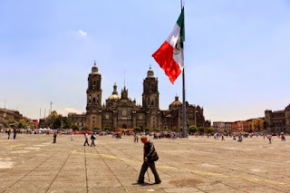
Zócalo
Main Plaza

second largest plaza in the world, 
after Red Square in Moscow.
  • México Barroco | Baroque Art: Representing Divine Ecstasy, Evoking AweIn Mexico, the art of the Baroque epoch (mid 17th to mid 18th centuries) is all around you in Centro and in many of the old churches throughout the city. It is the art of the height of the Spanish Empire, and it realized its most elaborate form in Nueva España. An excellent Wikipedia article on the Baroque helped us see its character as centered on grandeur, lavishness, and drama. We also came to realize the goal of its religious forms was to express holy ecstasy (stepping outside the ordinary world) and evoke awe. With that perspective, we explore the central and quintessential expression of Baroque religious architecture in Mexico City, the Metropolitan Cathedral. There are innumerable other examples in churches around the city.
El Sagrario
The Tabernacle portion of
the Metropolitan Cathedral,
in high Baroque style

IV. Thematically or geographically related pages

  • Mexico's History As Embodied In Mexico City: Lists and links to all posts addressing the many stages in Mexico City's history as they are manifested in the cityscape, from the indigenous reign of the Mexica/Azteca through the Spanish colonial period (1521-1821), and the 19th and 20th centuries, up to the Mexican Revolution (1910-17) and its aftermath. 
Chapultepec Castle,
scene of several significant events
of the 19th century.
  • Mexico City's Original Indigenous Villages and Their Spíritual ConquestContemporary Mexico City is an amalgam. It's core is the Spanish Colonial Centro. It did not significantly expand beyond that until the late 19th century. Then, in the second half of the 20th century, it exploded with rapid urbanization of previous lakebed and rural land. In that relatively recent explosion, it swallowed up ancient indigenous pueblos. These are villages, that, beginning some three thousand five hundred years ago, were established on the shores and islands of the five lakes at the center of the Valley of Anahuac. So Cortés and the Spanish not only had to transform Tenochtitlan, they also had to transform a geographically extensive civilization and culture via the "evangelización de los indios," or "los natuturales", what has been called the Spiritual Conquest. This series of posts explores the churches, neighborhoods and fiestas that continue to embody that encounter and the synthesis of the two civilizations. (This is our current work-in-progress).
Original, 16th century chapel of San Francisco,
in Quadrante (Quarter) of San Francisco,
originally the indigenous village of 
Hueytetitlan, now in Delegación Coyoácan.

  • Centro: El Centro, the Center of Mexico City, actually consists of five colonias, or neighborhoods: Centro Histórico, and East, West, North and South Centro. Spanish colonial palaces and smaller residential and commercial buildings from that period are numerous, but mixed in among them are buildings from the 19th and 20th centuries. Within them, and flowing among them in the streets, is the everyday, timeless activity of selling and buying.
Portable shoeshine stand
in Plaza 
de Santo Domingo
  • Chapúltepec Woods and Paseo de la Reforma: Five kilometers, three miles, southwest of Centro, on what used to be the western shore of Lake Texcoco, sits the ancient, sacred site of el Bosque de Chapúltepec, Chapultepec Woods. It was the first place that the Mexica/Azteca tried to settle down near the end of the 13th century, and later their royal retreat and source of fresh spring water for Tenochtitlan. The Spanish turned it into a park for themselves and continued to depend on its freshwater springs. 
Subsequently, a "castle", actually a palace, was built by a viceroy (ruling representative of the king of Spain) at the top of its landmark hill, an ancient ash cone volcano. After Independence was won from Spain in 1821, it served as the Mexican Military Academy and, in 1847, it was the scene of the last battle in the U.S. invasion of Mexico (aka Mexican-American War). In 1864, Emperor Maximilian I, put in place by Napoleon III of France at the request of Mexican conservative forces, decided to make it his palace. To connect it with the City Center, he had a boulevard built and named after his wife the Belgian Princess Carlotta. After his overthrow by liberal reform forces led by Benito Juárez in 1867. it became Paseo de la Reforma.
Paseo de la Reforma,
seen from Chapultepec Castle
  • Reign of Porfiro Díaz and Neighborhoods of the Early 20th Century: As the 19th century approached its end, Mexico City's well-to-do, who had increased in numbers under the economic policies of Porfirio Díaz (multiple times reelected president and dictator from 1876 to 1911), sought new residences outside the old Spanish Colonial Centro Histórico. They began to develop colonias, planned neighborhoods, to the west, along Paseo de la Reforma boulevard, and to its north and south. Díaz and the well-to-do had a great admiration for French culture. Hence, these colonias have a French flavor. Posts on six of these neighborhoods, with introductions, are listed.
French Second Empire-style homes,
with characteristic mansard roofs.
  • Mexican Revolution: Overview of Its Actors and Chapters: The Mexican Revolution (1910-1917) was a watershed between traditional and modern Mexico. Actually, a series of four civil wars fought between a diverse cast of characters with widely disparate histories and motivations, the war and its turbulent aftermath can be divided into five stages or chapters, each consisting of a number of critical episodes. This Page offers an overview of the war and links to Pages with fuller accounts of the personalities and each chapter of the war and its volatile aftermath.
Monument to the Revolution
  • Mexican Muralists: During the Mexican Revolution, a revolution in Mexican Art was triggered. After the Revolution, it unfolded in a group of buildings in Centro and expanded across the city throughout the 20th century. This page provides links to posts on the sites and their murals—works by the "Big Three": Diego Rivera, José Clemente Orozco, David Alfaro Siqueiros, and their successors, who continue to produce works up to the present.
Mural of Cortés and Malinche,
representing the mixing (mestizaje)
of Spanish and indigenous peoples.
by José Clemente Orozco,
in the museum San Ildefonso.

Tuesday, October 26, 2021

Mexico City's Green Spaces | Parque Masayoshi Ohira

Today, we visit a park very near where we live in the Borough of Coyoacán. It is the Parque Masayoshi Ohira, a Japanese garden that was created, surprisingly, in 1942 as a symbol of Mexican-Japanese friendship. There have been Japanese living in Mexico since the Colonial Period, but most have immigrated since the late 19th century.
 
The park was originally known as "The Pagoda Park" because of its original, predominant pagoda, which, unfortunately, burned down in the 1970s. 

The original pagoda

In the 1980s, it was renamed after Masayoshi Ōhira, the first Japanese prime minister to visit Mexico, who came in 1980 and died shortly afterward. It has been renovated a number of times, most recently in 2014, with the financial support of the Mexican-Japanese Association.

Although we have wanted to visit the park for some time, because it is across the Calzada de Tlalpan, a major highway with few crossings, it seemed difficult to access. But now that we can go back out into the city again, at least to open spaces, we decide to take another look at the map. We find that a pedestrian bridge only two blocks from our apartment crosses the Calzada and from there it is only a four or five-block walk to the park, less than half a mile. So one fine autumn day, off we go. 

Arriving at the park, which fills less than a city block, we circle around until we find the main entrance. It is dramatically framed by a torii, a gateway of red posts and a black top. Such torii are the traditional entrance to every Shinto shrine, marking the threshold between secular, everyday space and sacred space.

Torii gate at the entrance to Parque Masayoshi Ohira

Entering through the huge torii gate, we can see a pond in the distance, with two bridges and another torii gate, this one standing in the water. A number of dirt pathways lined with stone lead from the gate in various directions.

For some intuitive reason, we take a path to the right, towards the north end of the park and the pond. The path wanders gently from right to left and back, creating the feeling of a relaxed amble, just the experience we seek!

Soon, we arrive beside a paved square at the side of an opening in the stones that line the path. Clearly, it designates a vantage point for viewing the pond and the park around it. In the foreground is a gently arching, green, iron bridge. Near the middle of the water of the pond is the second torii arch. Beyond it, crossing a narrow branch of the pond, is a classic Japanese, bright red, bow bridge.

The whole composition communicates the tranquility of the traditional Japanese garden. It is definitely a place to escape the city's noisy bustle, a place to rest, to feel in contact with a miniature representation of the natural world, a place to regain contact with the center of one's own self.

The pond with its bridges and torii,
the threshold between the mundane and the spiritual.

At this moment, two young women walk up onto the green bridge. They stop to soak up the tranquility in the cooling shade falling on the bridge.


Now, we walk down the western side of the pond and have a serene view of the green bridge at the north end.


As we near the southern end, we get a good view of the torii gate standing in the middle of the pond.


At the southern end, we get a full view of the pond, with its red bow bridge in the foreground, the torii in the middle of the water, and the gentle green bridge in the shade at the north end, where we began our walk.


In classic Japanese style, the park recreates an enclosed, miniature, natural world with the simple but central elements of water, stones, plants and trees. Also, today, above the circle of evergreen trees, the sky provides a pure, intense blue ceiling, which completes the feeling of being totally embraced by Mother Nature.

In our private center, we feel the tranquility that this exquisite, archetypical design induces. We do not want to leave, but the world's agenda awaits us. We turn towards an exit, pledging to ourselves that we will come back other times, especially when we need an infusion of nature's tranquility.

Wednesday, August 14, 2019

Original Villages | Santiago Ahuitzotla, Azcapotzalco: Pueblo of Mythological Monsters, Friendly People

The Challenge of Getting to Azcapotzalco


Particularly because of the major historical importance underlying the Delegación/Alcaldía Azcapotzalco, as well as our desire to get to all sixteen delegaciones/alcaldias that comprise Mexico City (just a couple of weeks ago we made it to the fourteenth!), we have been wanting to get there for some time. However, the distance from our base in Coyoacán, which is in the geographic center of the City, to Azcapotzalco in the northwest of the City, plus the complexity of the public transportation route to get there (three Metro train lines to reach its historic center) resulting in at least an hour of travel time, kept us from achieving our goal.

Then recently, by sheer good fortune, a guided excursion led by Arqueologia viva México to the archeological site of Tenayuca, just north of Azcapotzalco in the State of Mexico, showed us that getting to Azcapotzalco wasn't as difficult as we had thought. A Metrobus to Tenayuca goes from a Metro train stop just west of Centro straight through Azcapotzalco.

Delegación Azcapotzalco
is the deep purple area in the northwest
of Mexico City.

Delegación Coyoacán is the dark magenta 
in the center of the City.

So we kept our eyes open for the announcement on Facebook of a fiesta in the delegación. It would be our fifteenth delegación — the next-to-last — to make an initial visit.

We did not have to wait long, just two weeks, when the fiesta of Santiago (St. James the Apostle) was to be held. Many pueblos in Mexico City — and across the country — are dedicated to Santiago, the patron saint of Spain. One of those pueblos turned out to be in Azcapotzalco, Pueblo Santiago Ahuitzoltla. Seeking it out on a set of Google Maps, which show all the pueblos and colonias of each of the delegaciones, we found it located in the delegación's southwest corner. It was also not far from a Metro train station on Line 7 that would require only one change of trains from Line 2, which runs north from Coyoacán through Delegacion Benito Juárez, then east through Delegaciones Cuauhtémoc and Miguel Hidalgo, just south of Azcapotzalco. Santiago Ahuitzoltla was within our reach. 

History of Azcapotzalco


Around 200 BCE, the Teotihuacan civilization arose in a side valley in the northeast corner of the valley now called the Valley of Mexico. By 100 CE it had come to exercise political and cultural control of the entire Valley and beyond. This included the west side of the lake — later to be called Texcoco — which was already settled, likely by Otomí. Over one thousand years later, the settlement  was to become Atzcapotzalco. When Teotihuacan waned between 500 to 800 CE, the area continued to remain an important center of that culture.

When the Toltec city-state of Tula rose, about 800 CE, to the northwest of the Valley, it, in turn, came to dominate the entire Valley. Then when Tula fell, around 1150 CE, the political instability created an opening for new migrations into the Valley. Among the groups moving in were a number of Nahuatl speaking, nomadic hunter-gatherer tribes coming from what is now the northwest of Mexico or the southwest of the United States. The Nahuatl language belongs to the Uto-Azteca language family of tribes in that area, including Ute, Shoshoni, Comanche and Hopi.

One of these tribes was the Tepaneca people, led, according to their oral history, by a chieftain called Matlacoatl. Their history, written down for the Spanish after 1521, states that, in 1152 CE, Matlacoatl established a village he named Atzcapotzaltongo. Remains related to that culture have been found in the area and dated between 1200 and 1230 CE. During the 13th century, the village grew into an altepetl, city-state, and gradually expanded its control over the southwest side of the Valley of Mexico.

Atzcapotzalco, a Tepaneca altepetl, lay on the west shore of Lake Texcoco.
Tenochtitlan was orginally one of its tributary cities from 1325 to 1438.

A tlatoani, "speaker", named Acolhuatzin ruled for sixty years, from 1283 to 1343. He married a daughter of Xolotl of Tenayuca, an atepetl just north of Atzcapotzaltongo. He also moved the city to what is now the historic center of present-day Atzcapotzalco, on the edge of what was Lake Texcoco.

In 1325, Acolhuatzin allowed the Mexica —  who had been expelled from land controlled by Culhuacan on the west end of the Iztapalapa Peninsula at the south end of Lake Texcoco — to settle on a set of Tepaneca-controlled islands in the lake, where they founded Tenochtitlan. In exchange, they owed Atzcapotzalco tribute and military service.

Later in the fourteenth century, the Tepaneca, with the aid of their Mexica subordinates, conquered Culhuacán and Xochimilco, thus gaining control of the south-central part of the Valley. In the early fifteenth century, the Tepaneca defeated the Alcolhua who ruled the east side of Lake Texcoco and thus became the major power in the Valley.

Atzcapotzalco continued to control much of the Valley of Mexico and over the mountains as far south as Cuernavaca (currently the capital of the state of Morelos) until the death of tlatoani Tezozomoc, who ruled for sixty years, during Tepaneca supremacy, from 1367 to 1427. Upon his death, a struggle among his sons over his succession gave tributary atepetls a chance to rebel.

The tlatoanis Nezahualcoyotl of the Alcolhuas, based in Texcoco, on the east side of the lake, Izcoatl of Tenochtitlan and Totoquihuaztli of Tlacopan, a Tepaneca village just to the south of Atzcapotzalco, formed the Triple Alliance and defeated the powerful altepetl in 1428. The former Tepaneca lands were divided among the three altepetls. The center of Atzcapotzalco was destroyed and turned into a slave market. Tlacopan (now modern Tacuba, in Delegación/Alcaldía Miguel Hidalgo) became the center of the reduced Tepaneca territory on the west side of Lake Texcoco. (Wikipedia, with additional information on Tepaneca expansion from The Aztecs Under Spanish Rule by Charles Gibson, Stanford University Press, 1964, Also, see our post: Portraying Mexico City's Azteca-Mexica Origins.)

The Fiesta of Santiago Ahuitzotla


So on the Sunday after July 25, Santiago's feast day, we head off via the Metro for Santiago Ahuitzotla, with no information as to the schedule of events, but guessing they would begin around 10 AM. It takes close to an hour, including a short cab ride from the Metro station, to arrive at the pueblo.

When we arrive at the church, we learn that a mass for children is about to begin.
Those who have just completed their catechism training wait outside 

in order to enter last and take front pews, where they will be specially honored.

The priest, dressed in the green robes of
of the post-Easter Trinity Season,
meets with the youth who have completed
their catechism training.

A gentleman rings the church bell announcing "tercera llamada",
third and final call that Mass is about to begin.

A simple portada of fresh flowers adorns the church's triple entrance.
  The sign reads, "Bless us, Lord Santiago."

We notice that the dome of the church is a well-preserved, elaborate mudéjar,
i.e., Islamic/Moorish design brought from Spain.
It contains what we know as the Jewish star
.
 
The Mass begins in the simple, flower-filled sanctuary.

The retablo (reredos) is Neoclassical in design, with its Roman Corinthian columns,
likely added in the late 17th or early 18th century, 
when Neoclassical architecture was replacing the ornate Baroque.

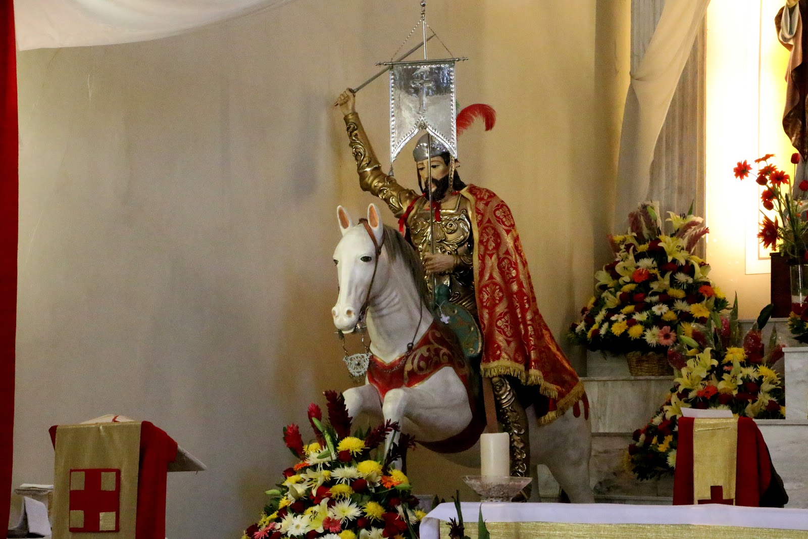
To the left is Santiago Matamoros, St. James the Moor killer, 
mounted on the horse on which he is reputed to have arrived miraculously 
in 9th-century Spain to help defeat the Moors.
To the right, he stands as an apostle and shepherd of his people. 

Santiago Matamoros

Outside, all is quiet.
Papel picado, paper cut in designs, announce the fiesta.


In one corner of the atrio, men are beginning construction of the castillo (castle)
of fireworks which will be set off after dark to culminate the fiesta.
 

The Procession


As the Mass is coming to a close, we hear the sound of cohetes, rocket-style firecrackers approaching from a distance. It is the procession of Santiago through the streets, which, we learn, began at nine AM. It is returning to the church in time for the main Mass to honor Santiago. Soon, it enters through a gate at the side of the church.

The procession enters, led by chinelos, dancers "disguised" in Moorish-style costumes
and masks "burlando", mocking, Spanish gentry.

The central figure wears a traditional chinelo mask imitating a bearded Spanish gentleman.
The pig faces are something we have never seen before on chinelos.
It seems a rather more blatant burla, mockery of the Spanish.

     
We are particularly taken by the elaborate shawl on the chinelo
to the right. It, too, is unusual.

Next comes the patron saint, Santiago.

Santiago is followed by an advocación, manifestation, of the Virgin Mary
that we have not seen before.
We ask a watching parishioner who she is. We are told she is the Virgen de los Remedios,
the Virgin of the Remedies.

We are somewhat taken aback. We have heard and read of la Virgen de los Remedios, but never seen her, as her basilica is outside the City. She is one of the most famous and important advocaciones. i.e., manifestations of the Virgin Mary as an advocate, a protector of the people, in the Valley of Mexico. Studies have shown she was sculpted in Spain. She was reputedly brought from there by Juan Rodríguez de Villafuerte, a captain in Hernán Cortés' army of conquistadors.

On the night of June 30-July 1, 1520, after the Spanish massacre of indigenous priests and nobles during an indigenous fiesta and the subsequent death of Moctezuma, the Spanish were forced to flee Tenochtitlan during the Night of Sorrows. After the surviving Spanish forces had crossed the causeway to Tlalcopan and were fleeing northRodríguez de Villafuerte ostensibly buried the Virgin beneath a maguey plant (a large succulent), hoping she would be safe there and that he might return someday to retrieve her.

She was discovered twenty years later by an indigenous peasant and became a highly revered version of St. Mary. In 1575, her own shrine was built where she was found, in Naucalpan, a city in the State of Mexico bordering on Azcapotzalco. It is now officially designated a basilica, a special church, by the Pope. With the Virgen de Guadalupe, in Tepeac to the north, the Virgen de la Bala (Virgin of the Bullet, in Iztapalapa) to the east and el Niño Pa (The Child [Jesus] of This Place, i.e., Xochimilco) to the south, she is considered one of the guardians of the four cardinal directions (an archetypical, indigenous symbolism) around the City of Mexico. During Colonial times, when there were major floods in the island City of Mexico, she—not the Virgin of Guadalupe—was brought to the Cathedral for the faithful to beseech her aid in stopping the flooding. As many as ten thousand faithful attend her feast day. Thus, it is a great honor for Santiago Ahuitzotla that she has been brought to participate in their fiesta.

A banda, as is traditional, follows at the rear.

The Mass honoring Santiago begins.
La Virgen de los Remedios is at the left,
together with a smaller version called a demandita (little prayer).

La Gente del Pueblo de Santiago Ahuitzotla, the People of the Village of St. James Ahuitzotla


While we were hanging out in the atrio between masses and awaiting the arrival of the procession, as usual, we introduced ourselves to a number of people who were also waiting. 

The man on the left approached us
(we always stand out as the only güero extranjero, pale-faced foreigner, at a fiesta)
and introduced himself as a member of the fiesta organizing committee
(note the figure of Santiago Matamoros on his shirt).
He then introduced us to the committee president (on the right)
and the pueblo's historian (center).
We gave them our card and told them we would be sharing our photos and story 

of their fiesta via Facebook.

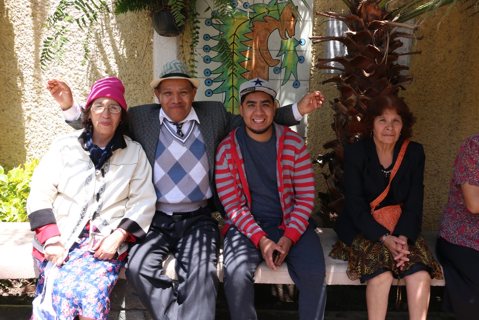
Familia mexicana.

Familia mexicana.

Couple upper right are brother and sister.
Couple lower left are mother and son. 

"What's in a name?" The Meaning of Ahuitzotla (Ahuizotlan)


The indigenous names of pueblos in the Valley of Mexico always have a meaning in Nahuatl, usually related to some identifying characteristic of its location or primary occupation (such as Iztacalco, House of Salt, as salt production was its major industry). So, of course, we wonder what Ahuitzotla means.

In ambling around the atrio, we discover a plaque of tiles embedded in the wall, almost hidden by a hanging plant.  We ask the young man pictured lower left above if he would hold aside the plant so that we may photograph the plaque. He is muy amable (very considerate) and readily assists us.

Plaque with glyph of Ahuitzotla,
or Ahuizotlan as it is spelled here,
indicating it was founded in the year 750 CE,
during the time when Teotihuacan dominated the Valley. 


We wonder what this strange creature is.

Once we are back home we search online for the possible meaning of Ahuitzotla  or Ahuizotlan as it is spelled on the plaque. We know that the prefix -tla or -tlan means place or territory, but what is an ahuexote or ahuizote ('x' and 'z' are both pronounced as 's' or 'sh'), evidently the curious creature displayed on the plaque. 

We quickly find a source in Spanish that tells us that in indigenous times, ahuexote / ahuizote were mythical, monstrous animals. Built like coyotes, they had spines on their backs, rather like a fish, and paws like a monkey´s so they could grasp objects. They also had a claw at the end of their tail. They lived in caves underwater and would lure human victims by making calls like a crying baby. When the victim came close to the water, they would leap out, grab them with their paws and claws and drag them underwater where they would be drowned and eaten. Why a pueblo, originally near the edge of Lake Texcoco, would be identified as the place where such monsters lived is a mystery. It would seem to have been a place to be avoided.

But we are most happy that we have come to Santiago Ahuitzotla in Delegación/Alcaldía Azcapotzalco. The people, as in all the pueblos we have visited, are most welcoming and open in talking with us. They express surprise and a sense of honor that an extranjero has come to their fiesta and will show and tell of it via Facebook and a web blog.

As for us, we have finally succeeded in getting to a place of great historical importance in the indigenous history of the Valley of Mexico, Azcapotzalco, the home base of the Tepanecas, the dominant power prior to the Mexica/AztecaAhuitzotla is just one barrio of the original city. We hope very much to get to others, over time. Meanwhile, we have also succeeded in getting to the fifteenth of the sixteen delegaciones/alcaldias of Mexico City.  

Delegación/Alacaldía Atzcapotzalco
with its pueblos and colonias.

Pueblo Santiago Ahuitzotla
is red area marked by mustard/yellow star.

Monday, July 1, 2019

Original Villages | Peñon de los Baños: The Battle of Cinco de Mayo

On el Cinco del Mayo, the Fifth of May, 1862, the Mexican Army defeated the French Army in the Battle of Puebla. The French, on the orders of Emperor Napoleon III and with the support of Mexican conservatives, had invaded the country to remove the Reform government of Benito Juárez and replace it with that of Emperor Maximilian I, a younger brother of the Hapsburg Emperor of the Austrian Empire. 

Unfortunately, reinforced French forces returned a year later and won the second battle of Puebla and then went on to take Mexico City. They installed Emperor Maximilian who ruled until 1867, when Napoleon realized he had to withdraw his army because of threats of war from adversary countries in Europe and pressure from the United States, which had just ended its Civil War. This left Maximilian with only limited conservative Mexican forces. The Reform army of the Juárez government quickly defeated the conservative Mexican army. It then captured Maximilian and, on Juárez's orders, executed him and the conservative Mexican generals to send a message to Europe that Mexico was a sovereign country, never to be invaded again.

The occasion of the first, victorious Battle of Puebla is grandly celebrated in the City of Puebla, but not much elsewhere in Mexico. There is, however, we learned, a celebration in Pueblo el Peñon de los Baños, the Rocky Mount of the Baths, whose history we introduced in a prior post. So, we attended the celebration of Cinco de Mayo in el Peñon in 2019. It turned out to be a delightful extravaganza.

When we arrive, the Mexican Army is gathering.


The hand carving on some of the rifle butts
is quite astonishing,
but then, this is Mexico,
a country of craftsmanship.

        
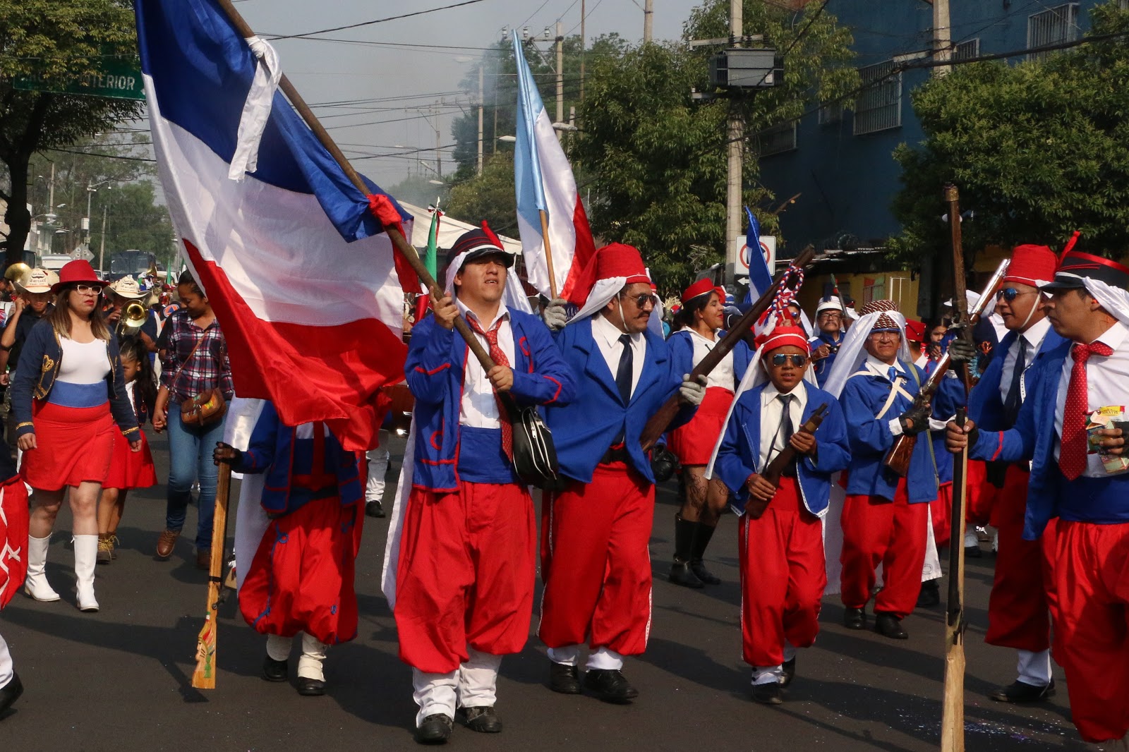
The French gather
on the opposite side.


Algerian forces?
France ruled Algeria from 1830.

The French advance against the Mexicans.

The Mexicans appear to retreat, firing cannons and rifles as they go.


For safety,
they fire into the ground
.

A banda, of course, sets the rhythm of action.

Irregular Mexican troops are coming up behind the French,
entrapping them.

We ask about the black faces.
"We are los indios!"


Evidently, the wealthy hacendados, owners of large rural haciendas, also take part.
By the way, la señora's skirt is also a work of art.

Charras, upperclass cowgirls, join in, too.
The defense of Mexico is a unified action.

Then another group appears
in dress we have never seen before!

Note the Virgin of Guadalupe,
the unifying symbol of
indigenous and
Spanish Mexicans

We are awed by the intricacy and beauty of their tocados (headdresses)
but have no idea who these people represent.
Then we see a banner saying they, too, are a battalion of los indios.

The battle moves up the peñon, the steep hill of the pueblo, such that we aren't able to follow to see the climax, but what we have witnessed has been quite exciting and intriguing. We wish we knew more about the black-faced indios and those in the elaborately ribboned tocados

In any case, with their participation, together with that of some wealthy hacendados, in addition to regular Mexican army troops, the message is definitely that of the unity of Mexico against the invasion of the foreign French. It is a day for Mexicans to be proud, a day to celebrate and remember. 

     
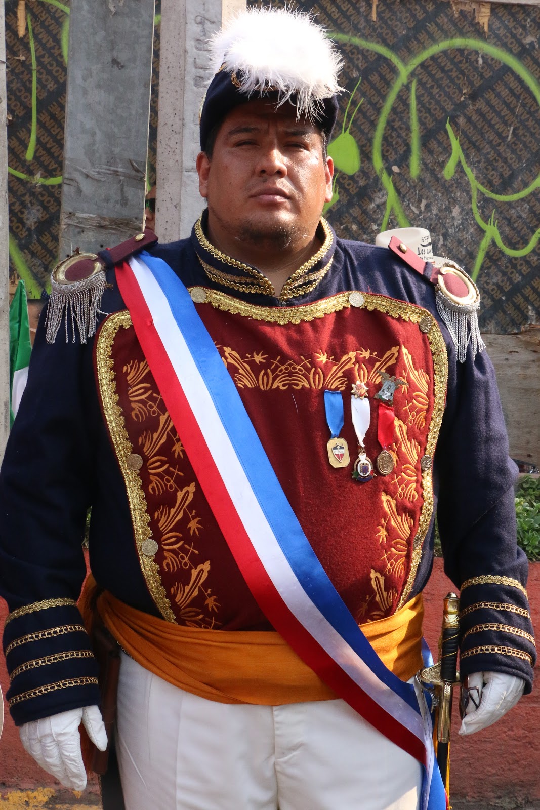
The crest is the Mexican national crest,
a golden eagle
with a serpent in its teeth,
seated on a nopal cactus.


¡Viva Cinco de Mayo! ¡Viva México!


Delegación Venustiano Carranza
(named after the first post-Revolutionary president, 1917-20)
Pueblos and Colonias

Pueblo Peñon de los Baños is dark blue area north of the Mexico City International Airport,
marked by red and orange star.
Terminal 1 of the airport is long, white building directly south of the pueblo.

Delegación/Alcaldá Venustiano Carranza
is the chartreuse area
in the northeast of
Mexico City