In our last post, Seeking Restored Vitality, we reviewed the colonias, neighborhoods, established at the end of the Porfiriato, at the turn of the 19th to the 20th century. Our focus was on the question of what made for the varying degrees of success we have observed in restoring their century-old, shared heritage of stylish homes and in integrating them with all the changes they underwent in that one hundred-plus years.
Our answer was that two things seem to have made the difference. First is their proximity to the major axis of Paseo de la Reforma with its dynamic fusion of the Mexican version of a 19th century European boulevard and pedestrian promenade with the skyscrapers of the contemporary global economy. Second is their having "good bones," public streets and parks inviting people to walk, sit and enjoy what is around them. We concluded that, among the colonias we have explored, Colonia Roma Norte, with its relative proximity to Reforma and its "good bones," was most successful in this endeavor.
End of the Porfiriato, Transition to a New Epoch
With that perspective, following the (mostly) charming Álvaro Óbregon Avenue west from Roma Norte, we cross Insurgentes Avenue and begin our amble through the last of the Porfirian colonias, the one known as Condesa. Actually, the area is comprised of four colonias, or parts thereof:
- Condesa,
- Condesa Hipódromo (Condesa Racetrack),
- Hipódromo, and
- One part of Roma Norte that—located on the west side of Insurgentes—is physically more connected to Condesa than to its eastern side.
- Chapúltepec Avenue to the north,
- Insurgentes to the east,
- Benjamin Franklin to the south, and
- José Vasconcelos to the west.
 |
| CLICK to enlarge any photo. A gallery of all photos will appear below it. |
During the Colonial period, the land was a hacienda, a large estate, owned by a series of countesses, hence the name. The original mansion still stands on José Vasconcelos Avenue, in the southwest corner of Condesa Hipódromo. The U.S.S.R. Embassy throughout much of the 20th century, it is today the Russian Embassy surrounded by a high wall, which makes picture-taking a problem, even worse than the modern U.S. Embassy on Reforma.
| Hipódromo of JockeyClub of Mexico as it was being converted into residential buildings in 1920s. Larger, outer ring is Amsterdam Ave. Photo: MXCity |
The shape of the racetrack, however, was preserved, which accounts for the oval shape of Parque México and Amsterdam Avenue, which circles it, and for the name of that colonia, Hipódromo. We will find that this difference between pre- and post-Revolution origins in development of the colonias is reflected in their architecture.
 |
| Parque España |
From this serene core, wide spokes of tree-lined streets with shaded camellones, medians, spread out to the north, west and south.
Two short blocks to the southeast is Condesa's larger, and more active heart, Parque México.
Two short blocks to the southeast is Condesa's larger, and more active heart, Parque México.
 |
| Art Deco clock points to the new architectural era in which the colonia developed |
We will come back to Parque México, but first, let's stroll out some of the spokes, the "bones" radiating from Parque España.
The Bones of Condesa
Tuning north from where Avenida Álvaro Óbergon touches the park, we walk up Avenida Oaxaca. through what is actually part of Roma Norte.
 |
| Avenida Oaxaca is one of the few avenues in Mexico City with a row of palm trees |
Along the way, we pass some old acquaintances:
 |
Neocolonial home, now a restaurant |
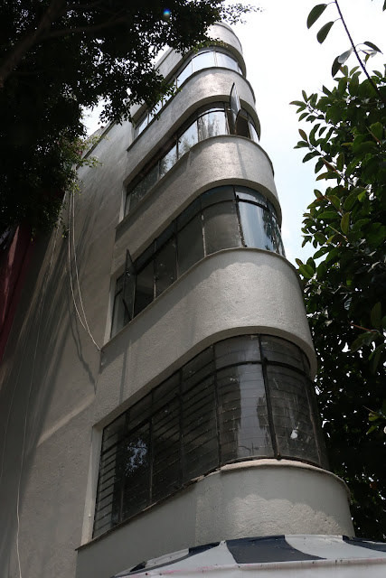
Amidst admittedly non-descript contemporary buildings, we have our first ecounter with a new, post-Revolution esthetic:
 |
| 1930s-40s Art Deco |
Oaxaca leads to a large traffic circle with a monumental statue at its center:
 |
| Fountain of Cibeles |
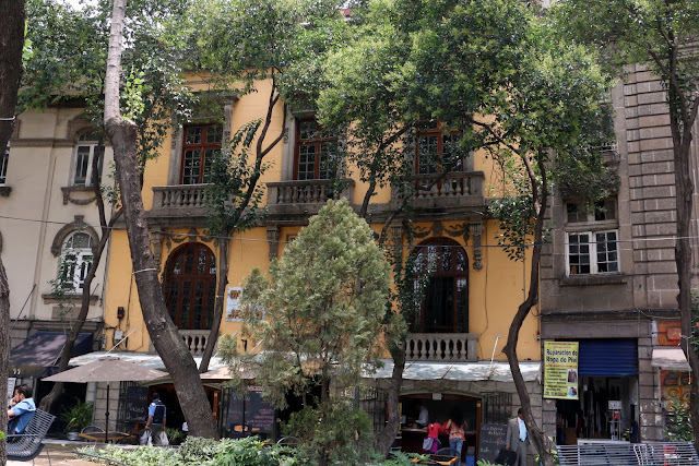
Around the outside of the traffic circle are more Neocolonial and Neoclassic buildings. Housing cafes, restaurants and other shops preserve the Porfirian European ambience.
Continuing up Oaxaca to where it meets Insurgentes and Chapúltepec Avenues at the huge glorieta, traffic circle, we encounter other vestiges of the Porfiriato. They are, however, rather more down-on-their-luck than those around the Fountain of the Cibeles.
 |
| Second French Empire buildings on Insurgentes |
 |
| Neoclassic mansion (Sign indicates that current commercial tenant uses side entrance) |
Reversing direction and heading back to the Cibeles Fountain, we angle southwest from Oaxaca and enter Calle [Street] Durango, the first of a chain of broad, shaded boulevards forming a semi-circle along the west side of Condesa, a kind of "ribcage" around the colonia's double hearts.
 |
| Camellón, pedestrian meridian down Calle Durango |
...a quiet blend of tradition and definitely upscale, contemporary urban life.
When Durango intersects with the wide Calle Veracruz, it bends more to the south and becomes Avenida Mazatlán.
 |
| Neoclassic mansion at intersection of Durango, Veracruz and Tampico |
Here we say goodbye to Roma Norte and enter Colonia Condesa proper. We also find that we have crossed another threshhold, leaving behind the Neoclassic and Neocolonial of the earlier established La Roma for ...
... that nostalgic, eclectic hybrid we have met in other Porfirian colonias, California Colonial, with its spiral columns and ornate dooways. The architecture tells us that we have entered a neighborhood established in the 1920's and 30's.
But then there appears a 1930's apartment building adopting formal Neoclassic elements.
Followed by more 1920's fantasy:
 |
| Medieval mixed with California Colonial, and |
As Mazatlán approaches the southern limit of Colonia Condesa at Avenida Michoacán, we find ouselves moving into an area of predominately utilitarian, unimaginative Post-World War II construction, where the ornamentations of pre-war fantasies are left behind.
Seeking to uncover more of the early 20th century "dreamed city" in Condesa, we turn northeast, up Michoacán, and walk towards its heart, Parque México, and our next post.
Other Posts on the Porfiriato Era
- The Porfiriato: French Culture Conquers Mexico City
- The Grandeza of Porfirio Díaz
- Inside Porfirio's Palace
- Centro Historico Porfiriato - Late Nineteenth Century Mexico City
- Colonia Santa María la Ribera: Early Twentieth Century Century Popurrí
- Colonia San Rafael: Decay, Renewal and Restoration
- Colonia Benito Juárez: Where History Lives in the Shadows
- Colonia Cuauhtémoc: The First Decades of the 20th Century Marry the First Decades of the 21st
- Colonia Roma Norte Part I: Houses—and a Culture—That Survived a Revolution
- Colonia Roma Norte - Part II: Dreams in Stone and Glass...and Paint
- Seeking Restored Vitality: Colonias of the Porfiriato Have Varying Success
Delegación Cuauhtémoc


No comments:
Post a Comment