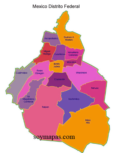
Showing posts with label Hernán Cortés. Show all posts

Tuesday, January 29, 2019

Original Villages | Coyoacán's Chapel of the Immaculate Conception of Our Lady, the Virgin Mary, Part I: Small Church with a Big History

Indigenous Coyoacán 

Es fácil traducir esta página en español: vaya a la columna a la derecha. En la parte más alta hay una ventana etiquetada "Translate". Desplace la flecha abajo hasta encuentra "Spanish". Click en ese y inmediatamente todo el texto estará traducido en español por Google. Con certeza, habrá errores, pero creemos qué el sentido se quede bastante claro.
When we wrote our initial post about Delegacion/Alcaldía Coyoacán, we began with a tour of its well-known, tourist-popular Center, officially la Villa Coyoacán and neighboring barrios. Originally, this was an indigenous urban center that had been in existence for at nearly two hundred years when Hernán Cortés, his Spanish troops and indigenous allies arrived in 1519 in the Valley called Anahuac. At that time, it was controlled by the Mexica (aka Azteca) of the island city of Tenochtitlán.

However, Coyoacán had been established by the Tepaneca. Like the Mexica, the Tepaneca were a Nahuatl-speaking people who had entered the north of the Valley around the year 1000 CE,  some three hundred years before the Mexica. By 1350, they had taken over the territory down the west side of Lake Texcoco as far as its southwest corner, where they built a village they likely named Coyoacán, Place of the Coyotes. The Tepaneca altepetl (city-state) was centered in Azcapotzalco, farther north along the southwest bay of Lake Texcoco.

Then, in 1428, the Mexica defeated Azcapotzalco and took control of its territories, including Coyoacán. As a major center in the southwest of the Valley, Coyoacán was crucial to the Mexica's political and economic control of that area and of the trade routes going south over the mountains, which they then also used for the military expansion of their empire.

Southwest Bay of Lake Texcoco.

Coyoacán
(spelled here Coyohuacan)
lay near the west shore at 
the south end of the bay of Lake Texcoco,
near the channel from Lake Xochimilco
(bottom center of map).

In the early 1400s, when the Mexica of Tenochtitlán
won control of the Valley from the Tepaneca
they built a causeway to Coyoacán,
via the island village of Huitzilopochco. 

Hernán Cortés Transforms Coyoacán from an Indigenous Altepetl to a Spanish Village


In August 1521, Hernán Cortés and his forces defeated the Mexica of Tenochtitlan, bringing the so-called Aztec Empire to a sudden end. While Cortés awaited the razing of Tenochtitlán and the building of the Spanish Ciudad de México atop its ruins, he took over this center of Coyoacán as his temporary headquarters. 

He chose Coyoacán as his base because its leaders and residents, being Tepaneca, had allied with him in his attack on Tenochtitlán, giving him free access to the entrance to the causeway that ran from there to the capital city, hence providing him with a strategic pathway for his assault of the island city.

Cortés named the town la Villa Coyoacán. Declaring it a Villa had specific political purposes under Spanish law. When Cortés landed on the mainland in February 1519, he immediately had his soldiers declare the establishment of la Villa Rica de la Vera Cruz, intending thereby to officially create a Spanish village according to Spanish law, with rights to elect its own leaders and to make direct appeals to the king. The "residents" of this Villa then elected Cortés the equivalent of mayor.

This was Cortés's way of claiming independence from the Governor of Cuba, who had charged him with an exploration of the mainland coast, not to land and attempt to conquer it. Thereafter, he bypassed the governor of Cuba and communicated directly with King Charles, reporting his victories and seeking the king's official approval and support. Declaring Coyoacán a Villa was a reinforcement of his claim to independence from the governor of Cuba and his right to act on behalf of the king in governing the newly conquered people and their territory.

During the three years that Cortés was based in Coyoacán, awaiting the construction of Spanish government buildings in the former Tenochtitlán, he had constructed an ayuntamiento (city hall) and residences for himself and his soldiers in la Villa. Thus he began the transformation of Coyoacán from an indigenous village into a Spanish villa whose colonial architecture and ambiance make it so picturesque and popular today.

History of La Capilla de la Concepción de Nuestra Señora, the Chapel of the Conception of Our Lady

The Construction of the First Christian Church in Nueva España, 


Being a devout Catholic and seeking to transform the defeated indigenous into believers in the True Catholic (Universal) Faith, Cortés also had a chapel built dedicated to the Virgin of the Immaculate Concepción. It was located just east of the center of the Villa. As such, it was the first Catholic Christian Church built in Mexico and evidently is the oldest continually existing church in the continental Americas.

Panama, called Darien by the Spanish, had been explored by them beginning in 1510, but Panama City was not founded until 1519. Apparently, a chapel was built sometime in the following decade, but later abandoned. The oldest existing church in Panama City is its cathedral, begun in the late17th century and completed over a hundred years later. The original chapel of la Concepción was remodeled in the late 17th or early 18th century and given a Baroque facade and gold retablo (reredos) behind the altar. It is familiarly referred to as La Conchita, "the Little Shell"

Chapel of the Immaculate Conception, 
"La Conchita", "The Little Shell".

The facade is in Baroque style, from the late 17th century.
Both the shape of the top of the doorway
  (archo mixtilíneo, arch of mixed lines),
and the diamond-patterned wall are mudéjar,
i.e., Muslim, designs adopted by the Spanish.
The chapel was completely restored between 2011 and 2015.

La Conchita Located Atop the Earliest Settlement in Coyoacán


As it happened, during the recent renovation of la Capilla de la Concepción Inmaculada (2011-2015), archeologists discovered that it had been constructed atop the site of the earliest settlement that was to become Coyoacán. Under and around the current plaza in front of La Conchita, they found remains of an initial settlement dating from around the year 200 CE. It was likely built by the first people to establish agriculturally-supported settlements in the Valley, the Otomí, who had domesticated the cultivation of corn in the Balsas River Valley, just over the mountains to the east (now in the State of Puebla). Hunter-gatherer tribes had been in the Valley since at least 9,000 years ago.

Some four hundred and fifty years later, in the 7th century CE, this settlement was considerably enlarged. Archaeologists have found evidence that it was taken over by the Tolteca, who had, earlier in the same century, taken over the village they called Culhuacán, The Place of the Old Ones, on the peninsula separating Lake Xochimilco, to the south, from Lake Texcoco to the north. At the same time, the Tolteca were developing the city of Tula, north of the Valley (now in the State of Hidalgo), which became the dominant power center in the area for five hundred years, until the middle of the 12th century. Within a few years, the Tolteca of Culhuacán crossed the narrow channel connecting the two lakes and took over the settlement in Concepcion, giving them control of the strategic waterway. They built a temple on the site that is now that of La Conchita.

Subsequently, in the 12th century CE, the site was abandoned for reasons the archaeologists haven't deciphered. This abandonment seems curious, as the Tolteca of Culhuacán remained a dominant power until near the end of the 14th century. It is even more intriguing that the major Tolteca city of Tula was also abandoned around the middle of the 12th century.

In any case, apparently not until two hundred years later, in the 14th century, was the area taken over by the Tepaneca. They built a new urban center just to the west of the first settlement, where the present Villa Coyoacán stands. They likely gave it the name Coyoacán. When the Mexica defeated the Tepanecas in 1428, they took control of this relatively new Coyoacán and expanded it even further.
Based on an article, Evidencias arqueologícas en el Centro de Coyoacán, Archeological Evidence in the Center of Coyoacán, by Juan Cervantes Rodado, María de la Luz Cabrera and Alejandro Meraz Moreno, in the magazine Arqueología mexicana, issue of Sept-Oct 2014, pp. 43-48.
So La Conchita is doubly important, as the 1,800-year-old site of the first settlement that was to become Coyoacán and as the earliest Christian church in Mexico, if not in all of the Americas.

Early Years of "La Conchita"


In 1519, Cortés had brought with him from Cuba a Dominican friar, Bartolomé de Olmedo, whom he placed in charge of the chapel. In 1524, a group of twelve Franciscan friars or monks arrived in Nueva España to evangelize, i.e., convert the indigenous to Catholicism, the so-called Spiritual Conquest. (Of an earlier group of three who arrived in 1523, only one survived, Fray Pedro de Gante Peter of Ghent, Flanders.) These friars were given charge of la Capilla. In 1529, Dominican friars arrived in Coyoacán and established the convent and church of San Juan Bautista, St. John the Baptist, in the center of la Villa. (See our initial Coyoacán post).

Coyoacán after the Spanish Conquest
(here spelled Coyohuacán)
and surrounding settlements with original indigenous names,
with convents and churches established by Franciscans and Dominicans.


El Convento de la Concepción de Nuestra Señora
is marked, with its plaza, just to the right of center.
San Juan Bautista is just to its west (left).

The dashed blue line to the east shows the location of the shore of Lake Texcoco in the 16th century.

Original indigenous settlements and roadways (in red) are overlaid on streets of modern Coyoacán, (in white).
From La evangelización del área coyoacanense en el siglo XVI,
The Evangelization of the Area of Coyoacán in the 16th Century, by Jaime Abundis
from Arqueología mexicana, Sept-Oct 2014 issue.

The Franciscans and Dominicans worked in concord in the center of Coyoacán until the Franciscans left in 1534 or 1535. They did so because indigenous leaders of Coyoacán demanded from the Audiencia — a royal commission established by King Charles to rule Nueva España in order to remove control from Cortés — that some of the land that had been taken by Cortés from them be returned.

The Franciscans chose not to oppose this demand and moved to nearby Huichilopochco (now called Churubusco) where they established a new church and convent dedicated to la Asunción de Nuestra Señora, the Assumption of Our Lady (upon her earthly death, that of the Virgin Mary directly into Heaven, where she was crowned Queen of Heaven). (On the map above, Huichilopochco is outlined in blue dashes, indicating it was an island. La Asunción is marked near its northwest shore.)

We have not yet been able to find out what happened to la Capilla de la Concepción after the Franciscans left. We know it was rebuilt in its present form during the Baroque period in the late 17th century. In any case, it is now a chapel under the direction of the Church of San Juan Bautista, itself a parish church.

La Conchita Rescued From the Edge of Collapse and Restored to Its Full, Original Beauty


When we arrived in Coyoacán in 2011 and began exploring the historic area, we found La Conchita in a state of great disrepair. A large fissure ran down the middle of its elaborate Baroque facade as if the building were about to split in two. Wooden braces supported the doorway. It seemed to be abandoned.

 La Conchita's facade in fall of 2011.
Note the fissure above the door and those running up each side,
through the floral-shaped windows.

Large fissure runs up the middle of the facade.

Archetypical symbols of the Sun and Moon,
shared by both indigenous religions and Christian Catholicism.
They represent complementary active, "masculine" powers
and receptive, nurturing "female" powers of creation
and the eternal cycle between light and dark
in all their forms.

In Catholicism, the sun is the prime symbol for the Divine Power,
God, the Father and Creator.
The Moon is a symbol for the Virgin Mary, "Our Lady",
Mother of Jesus, the Christ (Anointed Savior of humankind) and Son of God.

The wall pattern of diamonds is mudéjar, i.e., of Muslim origins.
The pillar is a specifically Baroque style.
(See our post: Mexican Baroque Art:
Representing Divine Ecstasy, Evoking Awe

However, most fortunately, later that year a major renovation of the chapel was undertaken by the National Institute of Anthropology and History (INAH) — the government institution responsible for the preservation and maintenance of Mexico's thousands of indigenous and Spanish colonial sites. For four years, La Conchita was hidden behind a wall of plywood.

During the restoration work, in May 2013, about 150 skeletons were found below the floor of the sanctuary. Many were of Spaniards given Christian burials, but at lower levels, skeletons of indigenous were found, along with a Toltec altar, documenting that the Toltecas had, indeed, lived there for five centuries. As is often the case with the original Catholic churches built in Nueva Espana, La Conchita had been built atop an indigenous temple site.

Burials discovered below the floor of La Conchita.
From. El Barrio de La Conchita
post on blog of Sergio Rojas
July 24, 2013

Restored Jewel


Finally, in 2015, the plywood walls were removed to reveal the chapel now standing in beautifully restored condition. However, when we paid a visit, it was closed. There was a guard, but he had no information when or if it was ever open.

Restored facade of
Chapel of the Immaculate Conception, 
"La Conchita", "The Little Shell".

So this fall of 2018, we were excited to see on Facebook an announcement of a celebration of the Immaculate Conception of Mary on her feast day, December 8, at La Conchita, la Capilla de la Concepción. No schedule of events was posted on the announcement, so we just decided to show up as early as we could that Saturday morning and see what would come to pass.

Few people are around the plaza in front of the chapel when we arrive, but we are delighted to see that the front door is open. Going in, we find a baptism in progress, in front of a gleamingly restored golden Baroque retablo (reredos), in an otherwise unadorned sanctuary.


Our Lady
of the Immaculate Conception


Franciscan friars,
one of a group of small paintings that fill the retablo.

Leaving the sanctuary and wondering what might happen next, we notice an announcement of fiesta events conveniently posted on the door of the chapel. It is now past 10 AM. Dances by two groups, one by "Moors", the other by "Concheros" are listed as having taken place at 9 AM. Apparently, we missed them.

While we are most happy to finally have had the opportunity to see the restored sanctuary, there are no more events listed until a 1:00 Mass. We are wondering whether to leave and return in the afternoon when, suddenly, a small procession appears, walking toward the chapel up one of the sidewalks that cross the arboleada (tree-filled) plaza.

This tells us that there is definitely going to be a fiesta of some form. It turns out to be quite unusual and well worth our staying. To experience the fiesta, see Part II of our posts on La Conchita.

Monday, July 18, 2016

Mexico City's Original Villages: Coyoacán's Many Pueblos

Es fácil traducir esta página en español: vaya a la columna a la derecha. En la parte más alta hay una ventana etiquetada "Translate". Desplace la flecha abajo hasta encuentra "Spanish". Click en ese y inmediatamente todo el texto estará traducido en español por Google. Con certeza, habrá errores, pero creemos qué el sentido se quede bastante claro.
We started Mexico City Ambles exploring the City's physical and historic Center, Colonial Centro Histórico. Then we moved on to explore the expansion of the City, beginning with the transition from Spanish colony to Mexican Independence (1821) and passing through the 19th century, with its vestiges of the volatile epoch of the Reform (1857-1876), the prosperity of the Porfiriato (1876-1911), with its initiation of many European-style, upper-class colonias, and arriving, lastly, at the Revolution (1911-1917), with its abundance of public art produced by the Mural Movement.

Having come up almost to contemporary times, our interest took a turn back to the beginnings of Mexico City and its development from the original Mexica city of Tenochititlan and the many altepetls, city-states, and pueblos that existed around Lake Texcoco. We discovered and explored the four original barrios or parcialidades of San Juan Tenochtitlan that still exist, almost hidden, in Centro Histórico. Now we find ourselves ready to return to our home base of Coyoacán and begin to explore its pueblos originarios.

We live in Colonia Parque San Andrés, St. Andrew's Park, an upper-middle-class, residential neighborhood of modern private homes, townhouse complexes and small apartment buildings, in Delegación Coyoacán, the borough of Coyoacán, Place of the Coyotes, about five miles south of the Zócalo in Centro Histórico, Delegación Cuauhtémoc.

Coyoacán is the deep purple, trapezoid-shaped delegación,
in the virtual geographic center of the City
just south of Benito Juárez, which is south of Cuauhtémoc,
the location of Centro Histórico.

1,800-Year-Old Village


Fountain of the Coyotes, in Jardin de los Centenarios, Garden of the Centenarians,
Villa Coyoacán

Before the arrival of the Spanish in 1519, the historic center of Coyoacán, named Villa Coyoacán by Hernán Cortés, about a mile west of Parque San Andrés, was an indigenous village with a long and complex history.

Archeological investigations have found remains of an initial settlement from around the year 200 CE. It is thought that before that time, Lake Xochimilco and Texcoco were larger and water covered this part of the valley. The settlement was a short distance east of the Villa in the location of what is now the Chapel of the Concepcion, built on Cortés' orders in 1521. It is now el Barrio Concepción. It is likely it was built by the first people to establish agriculturally-based settlements in the Valley, the Otomí, who had domesticated the cultivation of corn in the Balza River Valley just over the mountains to the east (now in the State of Puebla). Hunter-gatherer tribes had been in the Valley since at least 9,000 years ago.

In the 7th century CE. this settlement was considerably enlarged, likely having been taken over by Tolteca, the earliest Nahuatl-speaking tribe to enter the Valley they called Anahuac. Earlier in that century, they had first taken over a pre-existing village on the peninsula separating Lake Xochimilco, to the south, from Lake Texcoco to the north. They named their settlement Culhuacán, The Place of the Old Ones. They subsequently took over the settlement in Concepcion, across the narrow channel connecting the two lakes, giving them control of that waterway. For five hundred years, they maintained the settlement. In the mid 12th century, this site was abandoned for unknown reasons, which is curious, as the Toltecas, based in Culhuacán remained a major power in the valley until the 14th century.  

Meanwhile, around the year 1000 CE, another Nahuatl-speaking tribe, the Tepaneca, entered the Valley and, over time, took over the Otomí villages on the west side of Lake Texcoco, establishing their main city at Atzcapotzalco (now within the delegación of that name at the northern end of the City). By 1350, they had pushed south into what had been Tolteca territory. West of the abandoned la Concepción site, they built a larger village where the present Villa Coyoacán is located. It is possible they gave it the Nahuatl name of Coyoacán. 
Information from an article, Evidencias arqueologícas en el Centro de Coyoacán, Archeological Evidence in the Center of Coyoacán, in the magazine Arqueología mexicana, issue of Sept.Oct. 2014, pp. 43-48.
The Tepanecas of Atzcapotzalco and the Toltecas of Culhaucán, based on opposite sides of Lake Texcoco, were to remain competing powers until another Nahuatl-speaking tribe entered the Valley in 1225 and, over a two-hundred-year period, were eventually able to gain sufficient strength to challenge both.

These were the Mexica (aka Azteca), the last of the Nahuatl speaking tribes to arrive in the Valley. Over a period of one hundred years, they attempted alliances with various of the existing altepetls around the five lakes, including with the Toltecas. For a couple of decades at the end of the 13th century, they were able to maintain their own altepetl on the hill called Chapultepec, Then they were forced to become subjects, first, briefly, of the Tolteca of Culhuacán and then of the Tepaneca of Atzcapotzalco. The Tepaneca allowed them to finally obtained their own land, a set of islands in Lake Texcoco. There they founded their own altepetl, Tenochtitlan in 1325. As subjects of the Tepaneca, they helped them conquer the Toltecas of Culhuacán in 1385.
For a more detaiedl history of the entrance of the Mexica to the Valley and their two-hundred-year-long, circuitous rise to power, see our post: San Juanico Nextipac: Stepping Stone to History.
Over the next forty years, the Mexica became powerful enough that, along with allies from other altepetls (called the Triple Alliance), in 1428 they overthrew the Tepanecas and became lords of the entire Valley. Coyoacán came under their control. They expanded the city to an even greater size, as their main base of power and trade in the southwest of the Valley.

Scoring ring from ball court,
unearthed next to Church of San Juan Bautista,
Villa Coyoacán

The Mexica also built a causeway, now the Calzada de Tlalpan highway, south across the Lake from Tenochtitlan, creating branches at the entrance to the channel to Lake Xochimilco: the west branch ran to Coyoacán; the east branch to the peninsula they called Iztapalapa.

Major villages around the five lakes of the Valley
at the time the Spanish arrived in 1519

Transformation into a Spanish Village

As one of the main entrances to Tenochtitlan, via the causeway, Coyoacán held a strategic position. On the Noche Triste, Night of Sadness June 30, 1520, after the Spanish massacred Mexica priests and leaders and their tlatoani, ruler, Moctezuma was subsequently killed, Cortés and his troops had to flee from Tenochtitlan west to Tlacopan. They returned to the Valley in the spring of 1521, and Cortés gained the support of Coyoacán's Tepanec tlatoani to give him access to the causeway in order to attack the Mexica city. 

After Cortés conquered the city in August 1521, he then set up his headquarters in what he named Villa Coyoacán while the Mexica city was rebuilt into the Ciudad de México. As he had done upon landing on the mainland, establishing la Villa Rica de la Vera Cruz and having his troops elect him the equivalent of mayorin naming Coyoacán a "Villa", he was declaring it officially to be a Spanish village according to Spanish law, with rights to internal self-government by its Spanish residents (somewhat like an official village in the U.S.) and to direct appeal to the king. This was his way of claiming independence from the governor of Cuba, who had charged him with an exploration of the mainland coast, not to land and attempt to conquer it. He thereupon bypassed the governor of Cuba and communicated directly with King Charles, reporting his victories and seeking royal approval. 

Because of  Cortés choice of Coyoacán as his initial official seat of power, the earliest Spanish Colonial government buildings and churches in Mexico City and Mexico are here. (The earliest Spanish settlement on the continent had been established in 1510 in Panama).


Coyoacán after the Spanish Conquest
(here spelled Coyohuacán)
and surrounding settlements with original indigenous names,
and convents and churches established by Franciscans and Dominicans.

The dashed blue line to the east shows the location of the shore of Lake Texcoco in the 16th century.
The locations of original indigenous settlements and roadways (in red) 
are overlaid on the streets of modern Coyoacán, (in white).
The north-south roadway at far right was the causeway that crossed Lake Texcoco.

This map is the first we have seen giving original names we have not previously found
 of some of the indigenous pueblos,
many of which are no longer used.

From La evangelización del área coyoacanense en el siglo XVI,
The Evangelization of the Area of Coyoacán in the 16th Century, by Jaime Abundis
from Arqueología mexicana, Sept.-Oct 2014 issue,

Ayuntamiento, "City Hall"initially constructed by Hernán Cortés in 1521is the first Spanish government building in Mexico.

Chapel of the Immaculate Conception, 
"La Conchita", "The Little Shell".
Hernán Cortés had the first Catholic chapel erected here in 1521,
on an indigenous temple site,

 making it one of the first Catholic churches in the continental Americas. 
Subsequently, it was assigned to the Franciscans.
The structure was rebuilt in the late 17th century
with a Baroque facade.
Recently restored.

Church of San Juan Bautista, St. John the Baptist, Villa Coyoacán.
Original church built in the mid-16th century by the Dominicans.

Chapel of Santa Catarina
Site of original building erected by Dominicans in 16th century,
the current chapel was erected around 1650.

Originally, it was an indigenous settlement called Omac.

Transition to Modernity

During the Spanish Colonial period (1521-1821), the area remained one of scattered villages in the rural countryside. In 1857, during the Reform Era under President Benito Juárez, it was incorporated into the Federal District (now Mexico City). During the Porfiriato Era of the late 19th century, Villa Coyoacán and its original, adjacent colonias of Concepción and Santa Catrina, along with Del Carmen, built during the Porfiriato, became the site of "country homes" for wealthy city residents.

Frida Kahlo's family lived in the neo-colonial Casa Azul, Blue House, in Del Carmen. The house in which Leon Trotsky was assassinated is a couple of blocks north.

Garden of Frida Kahlo's Caza Azul, Blue House.

The delegación was created in 1928, when the Federal District was divided into sixteen boroughs. However, the urban sprawl of Mexico City did not reach the borough until the mid-20th century, turning farms and the former lakebed into developed areas (Wikipedia).

Today, the colonias of Villa Coyoacán, Concepción, Santa Catrina and Del Carmen retain much of their Spanish Colonial and early 20th-century Neo-colonial architecture and constitute a charming, upscale, tourist-filled neighborhood where chilangos (city residents) and tourists take a weekend break from the bullicio, the hustle and bustle, of the modern city. We frequently have Sunday brunch in one of its many restaurants.

Francisco Sosa Street,
lined with Colonial homes.
The design on the facade is Spanish Moorish.

The street was originally the indigenous pathway west 
to the village of Tenantitla, which is now Spanish Colonial San Ángel.

Many Coyoacáns

There are, however, other Coyoacáns. The Delegación encompasses twenty square miles, almost the size of Manhattan. It is divided into ninety-seven colonias of widely varying sizes. The Colonial-period and Porfiriato neighborhoods occupy only the northwest corner.

Delegación of Coyoacán
Calzada de Tlalpan divides it from north to south.
Avenida Miguel Ángel de Quevedo runs west to east.

In the northwest corner are
Villa Coyoacán (lavender-pink) 
and its adjacent colonias of 
 Concepción (gold), Santa Catarina (purple), and
Del Carmen (large, yellow-tan), 
The Calzada de Tlalpan, which crossed Lake Texcoco, touched land in what is now Barrio San Diego Churubusco (light blue ). The Spanish extended it south to the villages of Tlalpan and Xochimilco. It now divides the Delegación in half. Avenida Miguel Ángel de Quevedo and its extension on the east side of Calzada Tlalpan, Calzada Taxqueña, runs west to east.

  • East of the Calzada de Tlalpan was originally the channel connecting Lake Texcoco with Lake Xochimilco to the south. The former lakebed is now filled with late 20th-century housing and commercial shopping centers (think Home Depot and Walmart), which have replaced the indigenous chinampas ("floating gardens") of the lake and, after the Spanish drained the lake, Spanish haciendas (large estates for raising cattle or wheat).
  • The Far Eastern side of the Delegación was originally part of the peninsula of Iztapalapa and site of Culhuacán. It is now Pueblo San Francisco Culhuacan, divided into four barrios, and historically and still functionally connected to what is now Pueblo Culhuacan in Delegación Iztapalapa. We will explore both Culhuacans when we move on to Iztapalapa. 
  • The Southwest area was mostly scantily inhabited lava beds, pedregal (stony ground), created when, between 150 and 200 CE, the volcano Xitle buried the Otomi city of Cuicuilco. Dating from about 800 BCE, it was probably the earliest urban center in the Valley of Mexico. It was likely inhabited by Otomí people, the earliest known tribe to establish settlements based on corn agriculture in the Valley. The residents fled to the site that was to become Culhuacan and to Teotihuacan, the major Mesoamerican city in the north of the Valley. Part of the pedregal is now the site of the Ciudad Universitaria, University City, of the National Autonomous University of Mexico, UNAM. The rest is composed of two colonias, Ajusco and Santo Domingo, that were established by squatters in the 1960s and 70s when the city's population exploded from migrants coming from rural parts of Mexico. (See our page: How Mexico City Grew From and Island Into a Metropolis.)

Cuicuilco's Round "Pyramid"

Pueblos originarios

Running along the west side of the Calzada, north and south of Avenida Miguel Ángel de Quevedo (named after a mid-20th century architect and promoter of urban reforestation), and along the south side of Miguel Ángel, opposite Villa Coyoacán and its companion colonias, is yet another Coyoacán, a cluster of pueblos and barrios that were indigenous settlements long before the Spanish arrived.


Along the Calzada, north of Miguel Ángel, they are:
  • Barrio San Diego Churubusco (its indigenous name was Huitzilolpocho, originally an island under the control of Culhuacán, not Coyoacán)
  • Barrio San Mateo Churubusco (the southern part of Huitzilpochoco);
  • Barrio San Lucas (its indigenous name was Quiahuac)
West to east along Miguel Ángel
  • Barrio de San Francisco (its indigenous name was Hueytitlan);
  • Barrio de Niño Jesús (its indigenous name was Tehuitzco);
  • Pueblo de los Santos Reyes (its indigenous name was Hueytitlac).
Along the Calzada, south of Miguel Ángel
  • Pueblo de la Candelaria (its indigenous name seems to be unclear. We have read that it was called Tlanalapa or Tlanancleca; however, the rear side of its entrance arch says it was called Chinampan (area of chinampas, man-made islands in the lake) Macuitlapilco.
  • Pueblo de San Pablo Tepetlapa;
  • Pueblo de Santa Ursula Coapa.
These barrios and pueblos are among the one hundred and fifty pueblos originarios, original villages recognized by the Mexico City government. As such, they are living continuations of the Spiritual Conquest carried out by the Franciscans and members of other monastic orders. It is to them that we direct our next series of ambles.

See also:
Mexico City's Original Villages: Introduction - Landmarks of the Spiritual Conquest
The Spiritual Conquest: The Franciscans - Where It All Began
Coyoacán: Pueblo of Tres Santos Reyes and the Lord of Compassion
Coyoacán: The Lord of Compassion Goes Visiting
Coyoacán: The Lord of Compassion Visits Barrios San Lucas and Niño Jesús, the Child Jesus 
Coyoacán: Pueblo Candelaria Welcomes the Lord of Compassion 
Coyoacán: The Lord of Compassion Travels from San Pablo Tepetlapa to Santa Úrsula Coapa
Coyoacán: The Lord of Compassion Returns Home to Pueblo Tres Santos Reyes 
Coyoacán: San Mateo Churubusco - Identity Via Church and Market

Sunday, April 17, 2016

Mexico City's Original Villages: Introduction | Landmarks of the Spiritual Conquest

As we wrote in The Buried Heart of Mexico, Mexico City's Centro Histórico was previously the center of the Mexíca-Azteca city founded in 1325: México-Tenochtitlán.

In 1521, when Cortés defeated the Mexica in the name of the Christian god and the Spanish king, he had the surviving native Mexica expelled to Tlatelolco, just to the north, their city razed and the beginnings of a new Mexico City built above the old urban center. So the Spanish city and its contemporary Colonia Centro rest upon the buried indigenous capital.

The Palace and the Cathedral—framing the Zócalo and embodying in their grandeur the power of the Spanish State and the Catholic Church—were built over their respective political and religious predecessors, the "New Houses", the palaces of Moctezuma II, and the teocalli, house of god, Temple or Pyramid of the Sun. But that was only part of the task of attempting to replace one political entity, belief system and civilization with another.

Indigenous Context of the Spanish Conquest

As we wrote in our description of the geographic patchwork quilt that is contemporary Mexico City, it is an amalgam, not only of the colonial Centro Historico and its expansion beginning in the late 19th and across the 20th century, but also of ancient indigenous pueblos, villages, and altepetls, city-states that, beginning some two thousand years ago, were established on the shores of the five lakes at the center of the Valley of Anahuac and on some of their other islands as well.

Map of altepetls, city-states, and some villages 
at the time of the arrival of the Spanish in 1519.
Tenochtitlan is on the island
in the southwest corner of Lake Texcoco,
connected by causeways to other significant altepetls on the lakeshore.

Bernal Díaz del Castillo, one of Cortés's lieutenants, describes this complex lacustrine civilization:
"Gazing on such wonderful sights, we did not know what to say, or whether what appeared before us was real, for on one side, on the land, there were many great cities, and in the lake ever so many more, and the lake itself was crowded with canoes, and in the Causeway were many bridges at intervals, and in front of us stood the great City of Mexico." (The Discovery and Conquest of Mexico, by Bernal Díaz del Castillo, translated by A. P. Maudslay, De Capo Press, 1996)
Southwest Bay of Lake Texcoco
shows many more villages and small cities. 

These are what Díaz del Castillo, Cortés
and the other Spanish soldiers
would have seen as they progressed up the causeway
from Mexicaltzinco (lower right) to Tenochtitlan.


Cortés's Challenge: Spiritual Conquest

So Cortés not only had to transform the center of power, he also had to transform a geographically extensive civilization and culture. This meant implementing a program of radical reconstruction of the culture, of the peoples' customary ways of being and their organizing beliefs.

It required the "conversion" of el pueblo, the people residing in hundreds of villages in the Valley and thousands across the territory of Nuevo España, which soon extended south to South America and north to the nomadic tribes in the deserts of Sonora and Chihuahua and, eventually, beyond to what is now the Southwest United States. This project was the "Spiritual Conquest", which followed the military one.

As with most all of Mexican history, this Conquest is not something confined to "history", to the past. Remarkably, to this day the landmarks of this process remain standing. They are the ubiquitous churches and chapels established by various groups of Spanish Catholic friars—Franciscans, Dominicans, Augustinians, and many others—in the multitudinous colonial-period cities, towns and pueblos all across Mexico.

These landmarks of the Spiritual Conquest embody the political and cultural entrance of the Spanish into the indigenous communities. This entrance was carried out literally and symbolically by the "vertical" imposition of the Catholic God with the attendant belief system and priestly institutions, over the indigenous ones. Sites where Catholic churches were erected were not random. At the geographic center of the ancient villages, they were often erected atop the ruins of the temples of their indigenous predecessors, torn down by the Spanish friars.

This act of destruction of one culture and the attempt to create another had a paradoxical result. In the effort to replace the old gods and the religious practices honoring them, the Spanish established a physical, cultural and spiritual continuity with those very predecessors. It is noteworthy that the Franciscans, and other religious orders that followed them in coming to Nueva España, while they had indigenous temples torn down and statues of their gods destroyed, they deliberately adopted a strategy of seeking out elements in indigenous religious practice that had similarities to Catholic Christianity and building on them to teach the new faith as an evolution from the old, rather than trying to completely suppress old beliefs and practices. The indigenous were seen as children who needed to be "brought up" to the religious and cultural maturity of Spanish Catholicism.

Landmarks of the Spiritual Conquest in Mexico City

The existence and centrality of colonial churches is taken for granted in Mexico's colonial-era cities and towns, as well as in the Centro Histórico of Mexico City, with its Metropolitan Cathedral and many Baroque churches. What is surprising, at least to the foreigner, is that an almost countless number of such churches and chapels still stand in all the sixteen delagaciones, boroughs of the capital, and in hundreds of their colonias, neighborhoods, and throughout the surrounding urban sea that has replaced the original lakes and now fills the Valley of Mexico with 21 million people, the world's fourth-largest metropolis.

Mexica temples of Tlatelolco (15th century) stand in front of Church of Santiago, St. James.
The church was erected by Franciscans in 1545 and became a major center of 
evangelization. It was enlarged in 1609.

Tlatelolco was an altepetl, city-state, on an island just north of Tenochtitlán,
built by a group of Mexica who split off from those in the other city.
In the early 15th century, Tenochtitlán, now the dominant power in the Valley,

defeated the warriors of Tlatelolco and incorporated it into their city.
(See: Portraying Mexico City's Azteca/Mexica Origins)

Original Villages: Ancient Living Islands in the Urban Sea

What is even more remarkable is that around some of these churches there still survive vital pueblos originarios, original villages, whose contemporary residents trace their roots back to before the Spanish Conquest. They are living historical islands in the urban sea.

The Mexico City government officially recognizes 150 such original villages and has programs to support their continued life. There are more sites where the original churches still stand as landmarks of the Spiritual Conquest, but the people have been displaced by chilangos, outsiders who have moved in as part of the expansion of the modern city.

Original Pueblos of Mexico City
Ethnographic Atlas,
National Institute of Anthropology and History, 2007

The churches—physically marking the location of these original villages—remain the centers of barrio life. Each has its patron saint, assigned by the original friars and whose name is often combined with the original indigenous name of the settlement (e.g., San Matéo Churubusco, San Marcos Ixquitlán, San Pedro Cuajimalpa, Santa María Aztahuacán).

As one pueblo stated on its Facebook page:
The church ... plays an important role in the life of the people, since it is through the patron saint that the people of the community acquire a strong sense of belonging to their community. (The patron saint) constitutes the basis of social organization (embodied in the mayordomo, the head of the fiestas' mayordomía [commitee]) and symbolic consensus, since the patron saint is considered not only as the protector and the defender of the pueblo, but as the center where all social relations converge, the vital principle of the community and a key element of its identity.
Every year, each pueblo celebrates its patron saint's day, often along with other fiestas on the Catholic religious calendar such as Navidad (Christmas), Three Kings Day (Januaary 6), Candelaria (February 2), Semana Santa (Holy Week), Trinity Sunday (at the end of the Easter Season), Corpus Cristi (The Body of Christ, May or June,), the Assumption of the Virgin Mary into Heaven (August 15) and Día de los Muertos, Day of the Dead (November 1-2).

These fiestas are organized by committees of residents, often composed of key families of long-standing status, who by their faithful work earn the privilege of increasing responsibilities. The ultimate responsibility is to serve as mayordomo (head caretaker).

Patron Saint Festival of San Mateo (St. Matthew) Churubusco,
Delegación of Coyoacán.
"Glory to you, Lord"

Carnaval Festival,
Pueblo Santa María Magdelena Petlacalco,
Delegación of Tlalpan


Dancer is a "chinelo",
derived from the Nahuatl word “zineloquie”,
which means “disguised.”

Pueblos maintain connections with one another by means of "visits" of their saints to one another on their respective saint days. The visiting saints participate in the procession, a central event in the fiesta, and the celebrating parish hosts its guests with free, communally prepared meals. Some saints even spend part of the year on visitas, visits to various neighboring pueblos. Hosting these visits is a great honor.

Niño-pa de Xochimilco, Child God of Xochimilco,
visits Barrio Xoco (HO-ko) in Delegación Benito Juárez.
The two communities are about 9 miles apart. 

Next Mexico City Ambles

So, with this understanding, we head out on the next series of Mexico City Ambles, our own recorridos of a number of these original villages and their churches—living landmarks of the Spiritual Conquest begun by the Catholic friars, summoned from Spain by Cortés, nearly 500 years ago.

Series on Mexico City's Original Indigenous Villages:

Wednesday, March 2, 2016

Mexican Muralists in the Metro: Clash and Synthesis of Civilizations in Copilco Station

Opposite Sides of the Tracks

In the Tacubaya Metro Station, we saw the murals of Guillermo Ceniceros, an apprentice of David Siqueiros, portraying the legend of how, some seven hundred years ago, the Mexícas (Me-SHE-kahs) came to arrive in what was then the Valley of Anáhuac, now the Valley of Mexico, and found a city, México-Tenochtitlán. The murals introduced us to the atepetl, city-state's tlatoani, leaders, and some of its gods.

A few years later, in the early 1990s, the Metro System invited Ceniceros to create another set of murals, this time in Copilco Station on Line 3. This station is near the entrance to University City of the National Autonomous University (UNAM), which known for its own spectacular murals. Unlike the space in Tacubaya, where multiple corridors join to form a kind of multidimensional atrium experienced from many angles by travelers passing through it, the space in Copilco is formed by the two parallel train platforms and the walls enclosing them.

Ceniceros took advantage of the division of the tracks and the opposition of the parallel walls to present the story of the confrontation, clash and subsequent synthesis of the two civilizations that are the foundation of modern Mexico: the indigenous Mesoamerican and the European Spanish.


On one side, Cuauhtemoc 
who became tlatoani after Moctezuma the Younger was killed 
in a clash between his people and Cortés's soldiers
stands with his army of eagle warriors ready for battle.


On the opposite side, Hernán Cortés stands ready with his soldiers
and women given him by indigenous chiefs to make peace.

On the Mexica Side

In accounts dictated by Mexica and written down by Spaniards after the Spanish defeated the Azteca/Mexica in 1521, tales are told of a series of omens that had appeared in Tenochtitlan shortly before Cortés's fleet arrived off the Gulf Coast. Ceniceros paints these omens.

Mexica/Aztec god Tezcatlipocagod of twilight, ruler of the night, 
brings omens of destruction to his people.


Ghostly image appears of the god Quetzalcoatl, Plumed Serpent,
god of light, life and wisdom. (right, center)

In background, Temple of Huitzilopochtli, chief Mexica god,

bursts into flames without apparent cause.


A two-headed man and a crane with a mirror on its head appear.
In the mirror, images of strange objects floating on the sea could be seen.

On the Spanish Side

The Spanish arrive from Cuba, possessing three weapons not available to the Mexicas:

Horses


Firearms: Cannons and Muskets


and Attack Dogs

Once ashore, Cortés used threats of destruction and offers of benefits from Emperor Charles V, representative of the "One True God" and "True Ruler of the World", to gain thousands of indigenous allies. Some had been forced to give tribute to the Mexica; others, such as the city-state of Tlaxcala east of Tenochtitlan, had been the object of the Mexica "Flower Wars" instigated to collect captives for sacrifice, so many were looking for an opportunity to do in their enemies.

Nothing is shown in the murals of the actual conflict between the two armies. Nor of its consequences.

Joining Worlds

Instead, Ceniceros presents us with a more universal perspective—one where exploration connects previously autochthonous, or original cultures (Mesoamerican and Spanish), expanding and enriching both in a New World with broader horizons.

Christopher Columbus, right, stands next to early European map.
Next to him: Juan Sebastián Elcano, who, after Magellan died in the Philippines, 

completed the first circumnavigation of the Earth.

Left: in shadow, Paolo dal Pozzo Toscanelli, Italian astronomer who first proposed that one could sail west from Europe and reach China.


Rendering of map of Paolo dal Pozzo Toscanelli 


Various European explorers, including Marco Polo, Portuguese Prince Henry the Navigator,  Vasco de Gama, John Sebastian Cabot, Vitus Bering, Henry Hudson

From World History to World Art

Having set the historical context of the Age of Exploration and the encounter between "Western" and "New World" civilizations, Ceniceros then takes us to an even larger frame, the universality of art. To the right and left of each of the main, historical murals, he presents a series of reproductions of works of art from each of the two "worlds".

"Western" Art


Cave art of France, 20,000 BCE


Egypt


Assyria


Leonardo DaVinci
Italian Renaissance


Pablo Picasso
20th Century Spanish

"New World" Art

At each side of Cuauhtemoc and his people are murals portraying artistic works of the peoples of what are now the Americas:


Rock painting
Baja California


Pottery figures
Colima, West Mexico


Various Works


Monolithic Olmec head


Warriors in battle
Cacaxtla, Tlaxcala

Old Friends

Then, at one end of the "Mexican" platform, Ceniceros brings us back to a group we now consider old friends and to the very physical and temporal place where we began this series on Mexican muralism: Centro Histórico at the beginning of the Revolutionary 20th century.

José Guadalupe Posada (1852-1913)
political printmaker and engraver
whose shop was on Moneda Street, half a block from the Academy of San Carlos.
Posada's work influenced Orozco and Rivera, and many subsequent Mexican artists.


Diego Rivera
with section of mural Sunday in the Alameda
Rivera portrays himself as a child
holding the hand of Katrina, Lady of Death,
an image Rivera devoloped from similar ones by Posada.

Frida Kahlo stands behind.


Jose Clemente Orozco
La Trinchera, The Trench
Ex-Colegio San Ildefonso


David Alfaro Siqueiros
Fragment of mural in La Raza Hospítal

Where Ancient and Modern Voyagers Cross Paths


Thus, in Copilco Station, Ceniceros brings together "Old" and "New", Mesoamerican and European, past and present worlds. And this former New Yorker, who now ambles around Mexico City, feels right at home.

Credits


Work Team Copilco Mural